Scotland
Sgurr Eilde Mor
1010M
3314FT
About Sgurr Eilde Mor
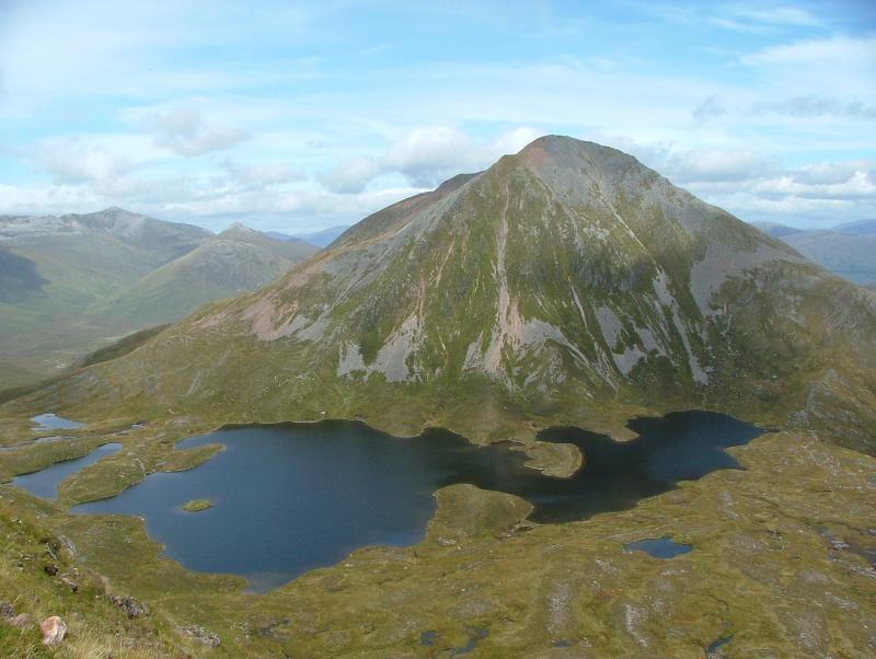
Tucked away at the eastern edge of the Mamores, this striking quartzite cone offers a rugged, scree-heavy ascent. Its pale, rocky summit stands in sharp contrast to the surrounding moorland, providing a spectacular vantage point overlooking the Blackwater Reservoir and the neighbouring giants of the Grey Corries.
Key Statistics
Rank
40th Highest in Region
Parent Range
Lochaber
Prominence
?
271m
Nearest Town
Fort William
Geology
You are walking over hard, transformed sandstone and volcanic rocks containing visible crystals. These durable layers form the solid foundation of this peak.
Find It
OS Grid Reference
NN230657
Latitude
56.7492°N
Longitude
4.8963°W
Did You Know?
- •The name is Gaelic for 'Big Peak of the Hind', referring to the female red deer that frequent the lower slopes of the Lochaber glens.
- •The mountain is largely composed of Binnein Quartzite, which gives the upper slopes their distinctive pale, almost white appearance, often mistaken for snow from a distance.
- •It is most frequently climbed alongside its neighbour Binnein Beag, with the high-altitude Coire an Lochain sitting in the col between them providing a popular spot for a mid-hike break.
- •From the summit, the view to the north is dominated by the jagged ridgeline of the Grey Corries, while to the south, the vast expanse of the Blackwater Reservoir stretches toward Rannoch Moor.
- •The final approach is infamous for its loose quartzite scree, a terrain that offers the unique experience of walking on a treadmill made of broken dinner plates.