Scotland
Binnein Beag
943M
3094FT
About Binnein Beag
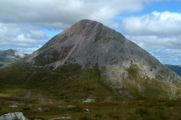
Tucked away at the eastern edge of the Mamores, this sharp quartzite cone offers a remote, wild character. While its name translates as 'little peak,' its steep, scree-clad slopes provide a rugged ascent and an exceptional, close-up vantage point over the Grey Corries and the massive north face of Binnein Mòr.
Key Statistics
Rank
63rd Highest in Region
Parent Range
Lochaber
Prominence
?
197m
Nearest Town
Fort William
Geology
You are trekking over tough, pale quartzite formed from hardened sandstone. Look for dark bands of volcanic rock that once squeezed into cracks in the mountain.
Find It
OS Grid Reference
NN221677
Latitude
56.7668°N
Longitude
4.9124°W
Did You Know?
- •Gaelic Binnein Beag translates to 'Little Peak.' It earned the name by being the smaller companion to the neighboring Binnein Mòr, which stands as the highest point in the Mamores range.
- •The summit is a distinctive cone of white quartzite scree. From a distance, this can give the peak a snow-dusted appearance even in the height of summer, a geological trait shared with several other peaks in the Lochaber area.
- •It is often considered one of the more remote Munros in the Mamores due to its position far from the road. The approach usually involves a long trek through the Nevis Gorge and past the 120-metre-high Steall Falls, one of Scotland's most impressive waterfalls.
- •The summit offers an excellent perspective on the 'back' of the Grey Corries to the north, specifically the steep eastern flank of Sgùrr Choinnich Mòr and the long, high plateau of Stob Coire an Laoigh.
- •Descending from Binnein Mòr to tackle this 'little' peak involves a 300-metre drop followed by a steep re-ascent, a sequence that ensures no walker treats it as a mere afterthought.