Scotland
Carn na Criche
1265M
4150FT
About Carn na Criche
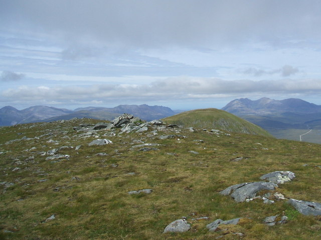
Carn na Criche is a high-altitude boulder-field masquerading as a summit on the massive Braeriach plateau. At 1,265m, it’s one of Britain's highest points, offering dizzying views into the Lairig Ghru. It’s perfect for those who enjoy arctic conditions, remote navigation, and extremely sore knees.
Key Statistics
Rank
5th Highest in The Cairngorms
Parent Range
The Cairngorms
Prominence
?
50m
Nearest Town
Newtonmore
Geology
Cairngorm Granite (Silurian/Devonian Intrusion)
Classifications
Nearby Fells
Find It
OS Grid Reference
NH196725
Latitude
57.7060°N
Longitude
5.0294°W
Did You Know?
- •The name translates from Gaelic as the 'Cairn of the Boundary,' traditionally marking the historical border between the lands of the Clan Grant and the Earls of Mar.
- •Despite being the eighth-highest point in the British Isles, it is technically classified as a Munro Top rather than a full Munro due to its lack of topographic prominence from Braeriach.
- •The plateau is home to the Wells of Dee, the highest source of any major river in the UK, where the infant River Dee begins its descent toward the North Sea.
- •This sub-arctic environment is a rare breeding ground for the elusive Dotterel, a bird that famously trusts humans so much it will often let you walk right up to it.
- •Navigating this summit in a mist is essentially a test of your sanity; you will spend an hour hopping across identical grey boulders wondering if you've actually moved or if the mountain is just moving with you.