Lake District
Harrop Pike
637M
2089FT
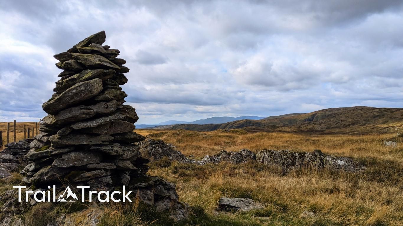
About Harrop Pike
Sitting on the quiet, peaty fringes of the Far Eastern Fells near Shap, this rounded Nuttall is best known for its remarkably tall, slender summit cairn. It offers a lonely, atmospheric experience, looking across the vast expanse of Mosedale towards Branstree and the more rugged profiles of the central Lake District fells.
Key Statistics
Rank
222nd Highest in Region
Parent Range
Far Eastern Fells
Prominence
?
15m
Nearest Town
Sadgill
Geology
Harrop Pike is built on the Wet Sleddale Andesite Formation. This hard volcanic rock was once molten lava flowing across the landscape.
Find It
Latitude
54.4630°N
Longitude
2.7718°W
Did You Know?
- •The name likely derives from the Old Norse 'hare' and 'hop', describing a remote side-valley or hill frequented by mountain hares.
- •The summit is marked by one of the most impressively constructed tall cairns in the Lake District. This slender stone pillar is a vital navigational landmark on an otherwise featureless, grassy plateau that can become disorienting in mist.
- •Although Alfred Wainwright chose to include the neighbouring Grey Crag in his Pictorial Guides, he omitted Harrop Pike despite its superior summit monument and distinct character, leading it to be categorised instead as a Birkett and Synge.
- •The view from the cairn provides a grand sense of scale, looking east across the low-lying M6 corridor toward the massive, level-topped profile of Cross Fell and the North Pennines.
- •Reaching the majestic summit pillar often requires a tactical approach through the surrounding peat hags, which are frequently deep enough to make one wonder if the cairn was built so tall simply to remain visible to walkers sinking into the moss.