Lake District
Burnbank Fell
475M
1558FT
About Burnbank Fell
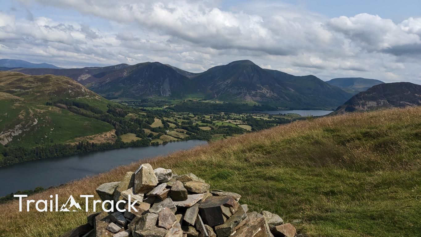
Sitting at the northwestern edge of the Western Fells, Burnbank Fell offers a straightforward climb from Loweswater. The summit is a simple grassy mound, but its position provides a unique perspective looking straight down the length of Loweswater towards the higher peaks of the Buttermere valley.
Key Statistics
Rank
467th Highest in Region
Parent Range
Western Fells
Prominence
?
22m
Nearest Town
Mockerkin
Geology
You are walking on the Loweswater Formation, a layer of coarse-grained sedimentary rock called wacke, formed from ancient river or lake deposits.
Classifications
Find It
Latitude
54.5759°N
Longitude
3.3783°W
Did You Know?
- •It marks the end of the Loweswater Fells ridge, acting as the final high point before the Lake District's mountainous terrain transitions into the coastal plains of West Cumbria.
- •The fell is composed primarily of Skiddaw Slate, resulting in smooth, rounded slopes and a predominantly grassy character that contrasts with the craggy volcanic rocks of the central fells.
- •The name is essentially a set of Old English directions: burna for the stream and banke for the slope. It tells you exactly what to expect—a sharp, sudden climb the moment you step away from the waters of Holme Beck.
- •The northern slopes are home to Holme Wood, a National Trust-managed ancient woodland containing Holme Force, a tiered waterfall that remains one of the area's quieter, hidden gems.
- •Navigating the summit is less about looking for landmarks and more about a dedicated study of the ground beneath you. You’ll spend most of your time staring at your feet, primarily to ensure the notorious Burnbank bogs don't claim a boot. It’s the kind of walk where a clear view of the horizon is a luxury you can rarely afford when the earth is actively trying to swallow you.