Scotland
Meall Ghaordaidh
1040M
3411FT
About Meall Ghaordaidh
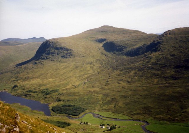
Rising between Glen Lochay and Glen Lyon, this Munro is defined by its broad, grassy flanks and notorious peat bogs. Though the ascent is a simple plod, the reward is a massive summit windbreak and clear views across to the jagged Tarmachan Ridge and the distant Ben Lui massif.
Key Statistics
Rank
15th Highest in Region
Parent Range
The Grampians
Prominence
?
492m
Nearest Town
Data coming soon
Geology
You are walking over lime-rich mudstones and layered rocks containing tiny garnets, formed from sediments squeezed deep beneath the earth.
Find It
OS Grid Reference
NN514397
Latitude
56.5258°N
Longitude
4.4167°W
Did You Know?
- •The name originates from the Gaelic Meall Ghaordaidh, most commonly translated as the 'Hill of the Shoulder' or 'Arm Hill', likely referring to the long, prominent spurs that extend from the summit plateau.
- •Most walkers approach from Duncroisk in Glen Lochay, following the Allt Dhùin Croisg; the route is famous among Munro baggers for its exceptionally soft, peat-filled terrain that rarely dries out completely.
- •The summit windbreak, which houses a trig pillar, provides a spectacular viewpoint for the neighbouring Ben Lawers range to the east and the sharp twin peaks of Ben More and Stob Binnein to the south.
- •Unlike the more rugged and interconnected peaks of the nearby Lawers group, Meall Ghaordaidh stands in relative isolation, making it a popular choice for a straightforward, standalone winter expedition.
- •The hill is frequently described by guidebook writers as a 'simple' walk, a term that conveniently ignores the high probability of your boots being submerged in black Highland sludge within twenty minutes of leaving the car.