Scotland
Beinn nan Oighreag
910M
2984FT
About Beinn nan Oighreag
Rising between the grander ranges of Meall nan Tarmachan and Ben Lawers, this bulky, grassy Corbett offers a quieter alternative to its Munro neighbours. It is defined by its broad, rolling ridges and a sense of isolation, providing an excellent vantage point across the deep trench of Glen Lochay.
Key Statistics
Rank
55th Highest in Region
Parent Range
The Grampians
Prominence
?
272m
Nearest Town
Data coming soon
Geology
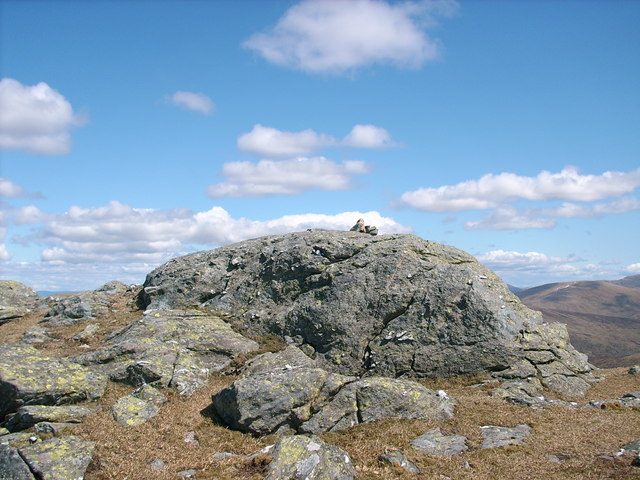
You are walking on the Pitlochry Schist. This rugged landscape is made of hardened, layered rocks that were once beds of sand and mud.
Find It
OS Grid Reference
NN541412
Latitude
56.5401°N
Longitude
4.3732°W
Did You Know?
- •The name is Gaelic for 'Hill of the Cloudberries.' It refers to the orange, raspberry-like fruit that thrives in the acidic, peaty soil found across these high-altitude Scottish moorlands.
- •Missing out on Munro status by less than five metres, it remains one of the highest Corbetts in Scotland. Its proximity to the 3,000ft mark often means it is overlooked by walkers focused on the more famous peaks of the Lawers range.
- •From the summit, the view south-west across Glen Lochay is dominated by the jagged skyline of the Crianlarich hills, specifically the massive twin profiles of Ben More and Stob Binnein.
- •While the hill can be reached from the Tarmachan Ridge via the Lairig Breac, the terrain in the connecting col is notorious among local walkers for its extensive and particularly deep peat hags.
- •It sits so close to the popular Ben Lawers visitor centre road that it feels like it should be a simple afternoon addition to the day, right until you realize the significant descent and re-ascent required to reach it.