Dartmoor & Exmoor
Barton Hill
311M
1020FT
About Barton Hill
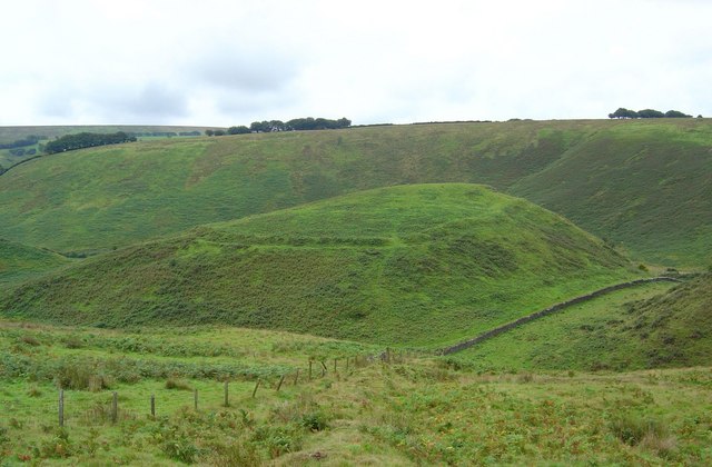
A lower hill (311m) situated above the River Barle valley, west of Simonsbath. A quiet spot offering classic Exmoor riverside scenery.
Key Statistics
Rank
51st Highest in Exmoor
Parent Range
Exmoor
Prominence
?
29.1m
Nearest Town
Simonsbath
Geology
Silurian Slates & Gritstone
Classifications
Nearby Fells
Find It
OS Grid Reference
SS975163
Latitude
51.1523°N
Longitude
3.8843°W
Did You Know?
- •The hill overlooks the historic village of Simonsbath, which manages the impressive feat of being the principal settlement for a massive 32-square-mile parish while housing fewer than 160 people.
- •It sits within the former Royal Forest of Exmoor, land that was largely treeless for centuries and served as a royal hunting ground before the Knight family attempted to civilise it in the 1800s.
- •The River Barle flows nearby, crossed by a triple-arched medieval bridge that had to be reconstructed after the 1952 Lynmouth flood decided the original wasn't quite sturdy enough.
- •While the Two Moors Way skirts the area, the local terrain is famous for 'Exmoor Mire,' a geological feature designed specifically to swallow hiking boots and dignity in equal measure.
- •At 1,020 feet, it technically clears the 'mountain' threshold by a whisker, though describing it as such to a Scotsman is a fantastic way to start a very long and one-sided argument.