Scotland
Doune Hill East Top
701M
2300FT
About Doune Hill East Top
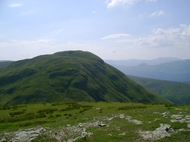
The slightly lower sibling to the Luss Hills' highest point, Doune Hill East Top provides a fine vantage point over Loch Lomond without the 'crowds' of the main summit. It is an exercise in navigating steep grass and testing the waterproof integrity of your gaiters.
Key Statistics
Rank
154th Highest in Loch Lomond and the Trossachs
Parent Range
Loch Lomond and the Trossachs
Prominence
?
78.3m
Nearest Town
Arrochar
Geology
Silurian Slates & Gritstone
Find It
OS Grid Reference
NS296974
Latitude
56.1388°N
Longitude
4.7439°W
Did You Know?
- •At 701 metres, this peak is classified as a Graham Top, sitting on the sprawling grassy ridge that dominates the skyline west of Inverbeg. It serves as a quieter sentinel overlooking the Firth of Clyde.
- •The area forms part of the traditional lands of Clan Colquhoun, who have lived on the shores of Loch Lomond for over 800 years. You won't find many castles up here, just sheep and silence.
- •Geologically, the hill is composed of Dalradian metamorphic rocks, though you’ll likely see more peat than stone. The rounded profile is a classic example of the softer, glaciated topography of the southern Highlands.
- •While the main Doune Hill attracts the 'baggers' looking for their Graham fix, the East Top is often visited as a tactical detour to extend the ridge walk before descending back toward the Luss glens.
- •The Luss Hills are famous for 'Luss Lurgies'—not a disease, but the soul-crushing realization that what looked like a solid path is actually a cleverly disguised vertical marsh. Pack spare socks and your best sense of irony.