Lake District
Darling Fell
392M
1286FT
About Darling Fell
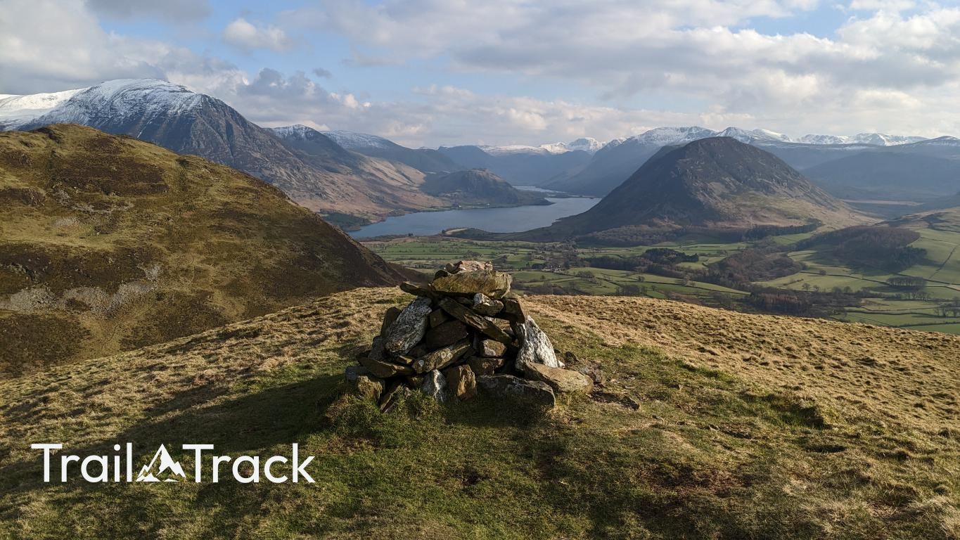
Darling Fell is a compact, grassy outlier of the Low Fell ridge that offers one of the best effort-to-reward ratios in the Western Lakes. It rises steeply above Loweswater, providing a stunning vantage point over the lake towards the bulky mass of Melbreak.
Key Statistics
Rank
623rd Highest in Region
Parent Range
Western Fells
Prominence
?
47
Nearest Town
Loweswater
Geology
You are walking on the Loweswater Formation, a layer of coarse, brecciated sandstone known as wacke that dates back to an unknown period.
Find It
Latitude
54.5902°N
Longitude
3.3485°W
Did You Know?
- •Darling Fell is separated from its higher neighbor, Low Fell, by a distinct grassy saddle, and together they form the southern terminus of the ridge extending from Fellbarrow.
- •The fell is composed of the Loweswater Member of the Skiddaw Group, a geological formation of siltstone and sandstone that is significantly older than the volcanic rocks of the central fells.
- •Its southern and eastern slopes are notably steep, featuring the Darling Fell Screes which drop sharply toward the shoreline of Loweswater.
- •While often overlooked in favor of Low Fell, the summit cairn on Darling Fell actually provides a more intimate and uninterrupted view of the Loweswater valley and the Crummock Water fells.
- •Despite its sweetheart name, the direct ascent from the lakeside is a relentless, calf-burning gradient that suggests the fell isn't quite as affectionate toward hikers as the name implies.