Lake District
Catstye Cam
889M
2918FT
About Catstye Cam
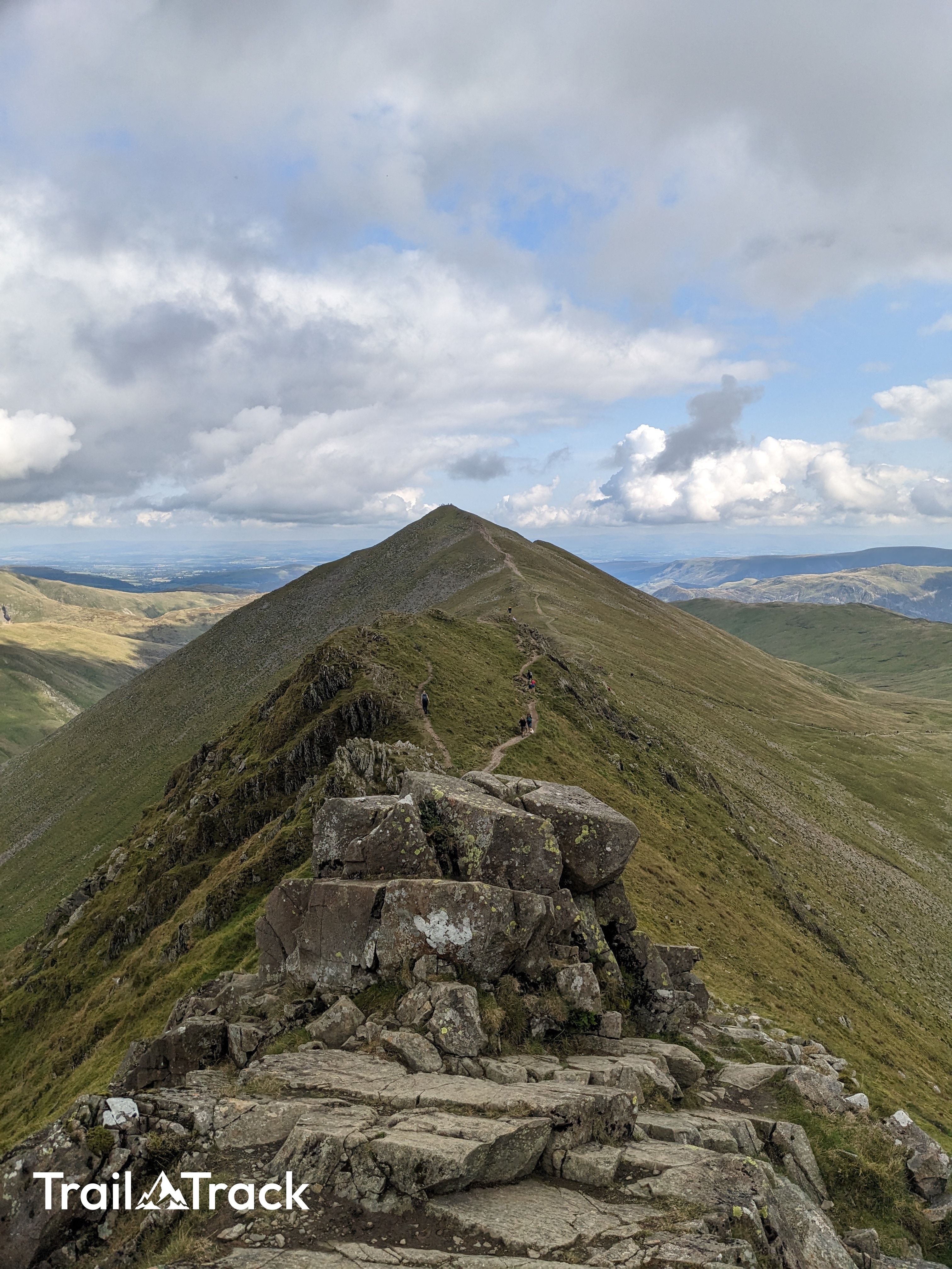
Catstye Cam is a classic pyramidal fell, arguably the most aesthetically pleasing peak in the Eastern Fells. While often treated as a quick detour from Swirral Edge, its sharp ridges and steep grassy slopes offer a rewarding, direct ascent from Glenridding with fantastic views over Red Tarn.
Key Statistics
Rank
18th Highest in Region
Parent Range
Eastern Fells
Prominence
?
62.4
Nearest Town
Patterdale
Geology
Your footing rests on the Esk Pike Sandstone Formation of volcanic mudstone, overlain by Helvellyn Tuff Formation lapilli‑tuff, with a later Middle Dodd Dacite intrusion.
Find It
Latitude
54.5335°N
Longitude
3.0089°W
Did You Know?
- •The name is likely derived from the Old Norse 'katts-stigi', meaning the 'path of the wild cat', paired with 'cam', a common Northern English term for a sharp ridge or crest.
- •Geologically, the fell is a textbook example of a truncated spur. It was formed when massive glaciers carved out the deep troughs of Glenridding and Keppel Cove on either side, leaving this sharp ridge standing between them.
- •Alfred Wainwright held the fell in exceptionally high regard, describing it as having a 'true mountain shape' that few other Lakeland fells can match. He praised its symmetrical elegance and its status as a landmark for those approaching from the east.
- •The slopes above Keppel Cove were once bustling with industry; hikers can still spot the remains of an 18th-century dam and various water leats that were once used to power the heavy machinery at the Glenridding lead mines.
- •If you approach from the Helvellyn side, the summit feels like a complete gift. You simply stroll down a wide, easy grassy path for five minutes while looking down with pity on the people sweating their way up the rocky scramble of Swirral Edge.