Lake District
Carl Side
747M
2450FT
About Carl Side
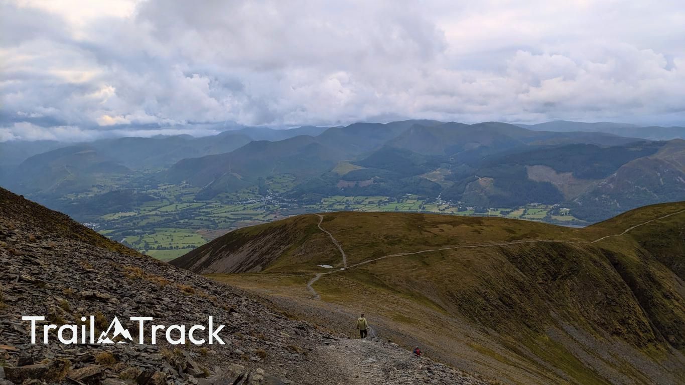
On the southern side of Skiddaw, Carl Side offers a more rewarding route than the main path. The climb rises over steep scree and along Longside Edge from the west. The summit is broad and grassy, with clear views across the surrounding fells and down to the town below.
Key Statistics
Rank
111th Highest in Region
Parent Range
Northern Fells
Prominence
?
28.3m
Nearest Town
Applethwaite
Geology
Carl Side is built from ancient layers of hardened mud and silt, alongside a gritty type of sandstone known as wacke.
Find It
Latitude
54.6424°N
Longitude
3.1560°W
Did You Know?
- •The name likely derives from the Old Norse 'karl', meaning a free man or a peasant. In the context of Lakeland fells, it suggests the hill was once common land used by local farmers rather than being part of a private estate.
- •Alfred Wainwright was a vocal admirer of the view from this summit, famously stating that while Skiddaw's own top is too high to appreciate its own scale, Carl Side provides the perfect perspective of Skiddaw’s massive slate pyramid.
- •The fell is the junction for one of the Lake District’s most dramatic ridge walks; the crossing from Ullock Pike along Longside Edge terminates here before the final, steep grind up the 'Carlside Col' to Skiddaw’s main summit.
- •From the summit cairn, there is a celebrated 'double-lake' view, where the eye can trace the entire length of Bassenthwaite Lake to the northwest and Derwent Water to the south, separated by the flat green basin of the Keswick valley.
- •The direct descent from the summit towards Millbeck is notoriously steep, dropping through a series of heather-clad terraces and scree that can be punishing on the knees after a long day in the Northern Fells.
- •The path leading north from the col towards Skiddaw consists of loose, sliding slate scree that provides a masterclass in the 'two steps forward, one step back' school of mountaineering.