Lake District
Calf Crag
537M
1761FT
About Calf Crag
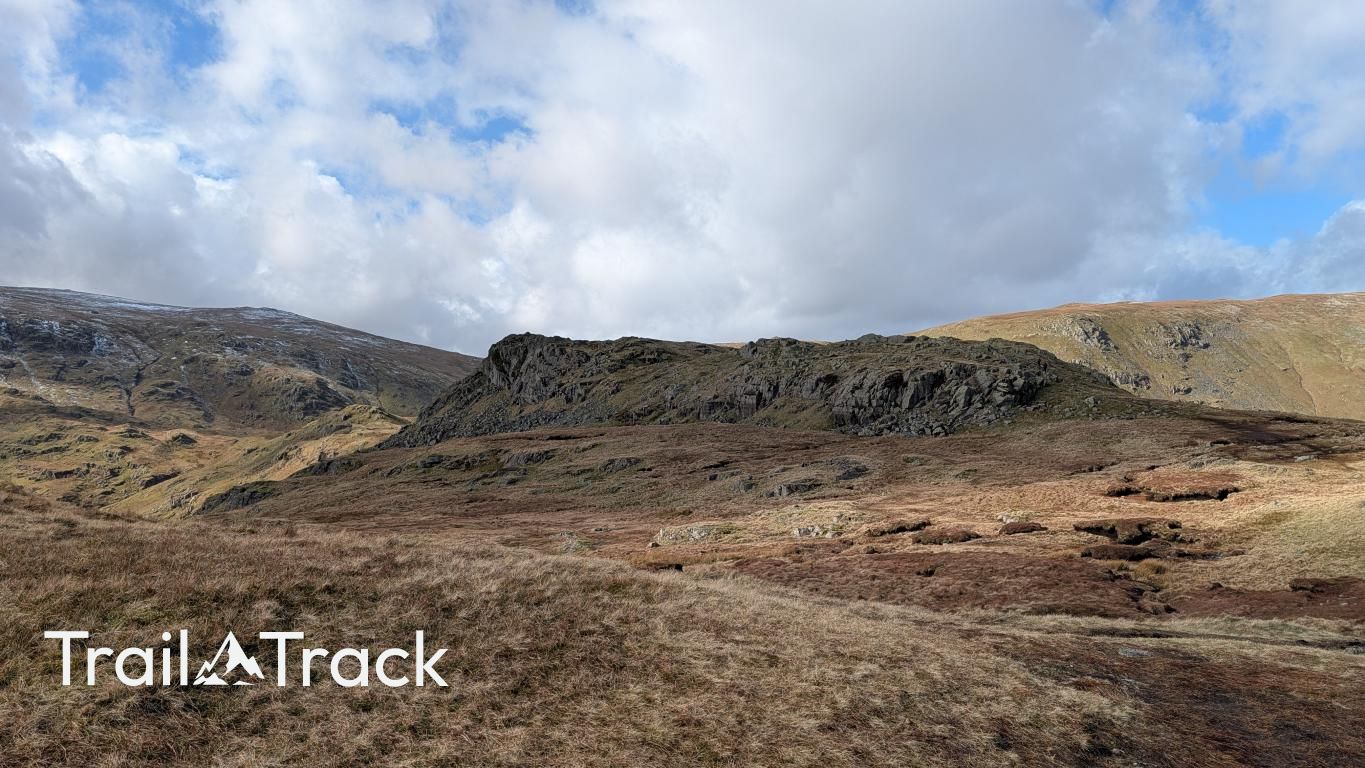
Sitting at the head of Far Easedale, this rugged Central Fell marks a turning point on the ridge walk from Grasmere towards High Raise. Though modest in height, its rocky summit provides a satisfying sense of scale, overlooking the glacial trench of the valley and the surrounding crags of Gibson Knott.
Key Statistics
Rank
351st Highest in Region
Parent Range
Central Fells
Prominence
?
50m
Nearest Town
Elterwater
Geology
You are walking over layers of compressed volcanic ash and stony debris. These foundations formed from explosive eruptions and sediment washed down from ancient volcanic slopes.
Classifications
Find It
Latitude
54.4842°N
Longitude
3.0795°W
Did You Know?
- •The name likely derives from the Old Norse 'kalfr', meaning calf, which was often applied by Viking settlers to a smaller hill or rock sitting alongside a larger mountain—in this case, the much bulkier massif of High Raise.
- •Alfred Wainwright regarded this fell as the natural conclusion to the delightful ridge walk from Grasmere, famously describing the undulating approach over Helm Crag and Gibson Knott as 'a ridge-wandering par excellence.'
- •While often reached via the popular ridge route, the descent into the quiet, glacial U-shaped valley of Far Easedale offers a much more secluded return path, following the clear waters of Far Easedale Gill back to the village.
- •From the summit rocks, walkers earn a particularly sharp view down the entire length of Far Easedale towards Grasmere, framed by the steep slopes of Steel Fell to the north and the distinctive 'Lion and the Lamb' on Helm Crag to the south.
- •The summit plateau is a confusing sprawl of peat hags and rocky outcrops; it is the kind of place where a walker can claim three different 'highest points' in five minutes without ever being entirely sure they have stood on the real one.