Northumberland
Windy Rig
561M
1841FT
About Windy Rig
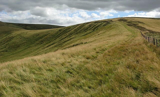
Tucked away in the remote upper reaches of Coquetdale, this grassy hump on the Anglo-Scottish border offers a quintessential Cheviot experience. Often bypassed for its more famous neighbour, Windy Gyle, it provides a quiet, unhurried perspective over the deep trench of the Coquet Valley and the rolling, empty moorland of the Border Forest.
Key Statistics
Rank
15th Highest in Region
Parent Range
The Cheviots
Prominence
?
22m
Nearest Town
Northumberland
Geology
You are trekking across ancient volcanic lavas, layered sandstones, and pebble-rich rocks. These diverse materials form the rugged geological foundation beneath your feet.
Classifications
Find It
OS Grid Reference
NT845153
Latitude
55.4313°N
Longitude
2.2465°W
Did You Know?
- •The name 'Rig' or 'Rigg' stems from the Old English 'hrycg', meaning a long, narrow hill or ridge, which perfectly describes this shoulder of high ground overlooking the border.
- •The summit marks a literal boundary; the fence line crossing the hill delineates the border between England and Scotland, specifically between Northumberland and the Scottish Borders.
- •It is frequently bagged as part of a high-level circuit from Alwinton, often combined with the ancient Clennell Street, a historic cross-border drovers' road used for centuries to move livestock.
- •The summit offers a clear, unobstructed view of the deep, winding cleft of the River Coquet to the south and the prominent rounded dome of Windy Gyle to the west.
- •True to its name, if you find the summit calm enough to consult a paper map without it doubling as a kite, you have likely caught the Cheviots on their one day of annual leave.