North Pennines
Whit Fell
411M
1348FT
About Whit Fell
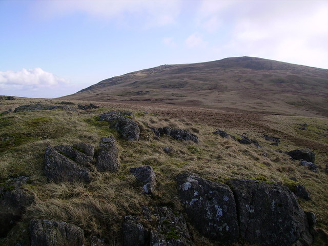
Rising above the village of Newbiggin-on-Lune, this grassy Tump marks the quiet northern fringe of the Yorkshire Dales. It offers a peaceful alternative to the popular Howgill peaks, providing an expansive vantage point over the upper Eden Valley toward the looming profile of Wild Boar Fell and the North Pennines.
Key Statistics
Rank
224th Highest in Region
Parent Range
Yorkshire Dales
Prominence
?
Data coming soon
Nearest Town
West Burton
Geology
Whit Fell is composed of layered sandstone, siltstone, and mudstone. These sturdy rocks form the rugged ground beneath your feet.
Classifications
Find It
OS Grid Reference
SE086945
Latitude
54.2570°N
Longitude
1.9540°W
Did You Know?
- •The name 'Whit' likely derives from the Old English 'hwit', meaning white, which usually referred to the pale, bleached bent-grass characteristic of these limestone-edged slopes or perhaps the way snow lingers on its northern face.
- •From the summit, the view to the east is dominated by the dramatic escarpments of Mallerstang Edge and the high plateau of Wild Boar Fell, while the south reveals the distinctive 'sleeping elephant' profiles of the higher Howgills.
- •The hill is frequently bagged as part of a circular walk from Ravenstonedale, often linked with the nearby Nettle Hill to explore the transition between the lush valley pastures and the high, wild moorland.
- •Despite being a classified Tump, the summit is so unassuming that a first-time visitor might find themselves checking their map twice to ensure they haven't simply stopped for a rest on a particularly large sheep-mound.