North Pennines
Viewing Hill
649M
2129FT
About Viewing Hill
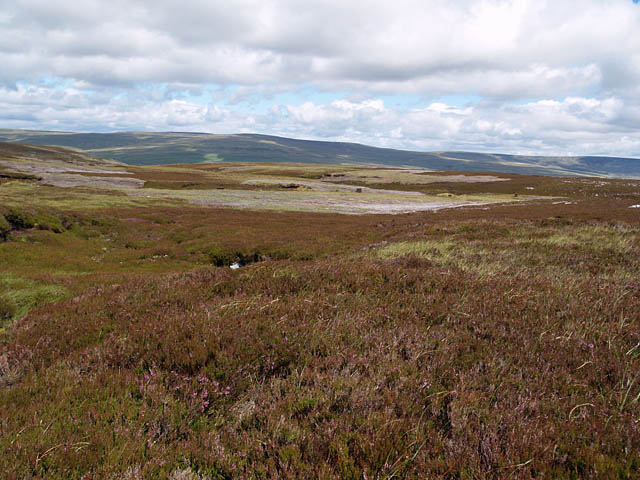
Resting on the remote moorland border between Cumbria and County Durham, this broad Hewitt provides a quiet, peat-strewn perspective of the North Pennines. Often overlooked for its neighbour, Mickle Fell, it serves as a superb vantage point over the dark waters of Cow Green Reservoir and the distant, high Cross Fell range.
Key Statistics
Rank
61st Highest in Region
Parent Range
North Pennines
Prominence
?
67m
Nearest Town
County Durham
Geology
Viewing Hill is built on layers of limestone, sandstone, and mudstone. These sturdy rocks create the solid foundation beneath your feet as you climb.
Find It
OS Grid Reference
NY789331
Latitude
54.6925°N
Longitude
2.3289°W
Did You Know?
- •Unlike many surrounding peaks with Old Norse or Celtic roots, the name is a straightforward English descriptor for its role as a natural lookout over the upper Tees valley.
- •The summit acts as a significant drainage divide; rainfall here either travels east toward the North Sea via the River Tees or west toward the Irish Sea via the River Eden.
- •For many years, the hill marked a point close to where the historic counties of Westmorland, Durham, and the North Riding of Yorkshire met.
- •To the east, the view is dominated by the sprawling Cow Green Reservoir, an artificial lake completed in 1971 that submerged portions of the botanically significant upper Teesdale landscape.
- •It is a frequent objective for walkers when the more prominent Mickle Fell to the south is inaccessible due to live firing exercises on the Warcop Training Area.
- •Given the name, it is a minor local irony that the summit is frequently cloaked in mist, restricting the famous view to the nearest clump of saturated peat.