Lake District
Ullscarf
723M
2372FT
About Ullscarf
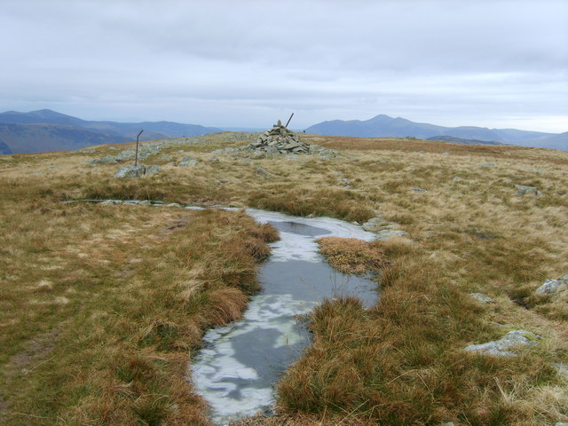
Ullscarf acts as a high-altitude link between Borrowdale and Thirlmere, offering a long, broad ridge walk. While the summit itself is relatively featureless, the views across to the Langdale Pikes and Helvellyn range are expansive, provided you navigate the notoriously spongy ground safely.
Key Statistics
Rank
137th Highest in Region
Parent Range
Central Fells
Prominence
?
114.1m
Nearest Town
St. John's Castlerigg and Wythburn
Geology
Ullscarf’s ground is made of the Lincomb Tarns Tuff Formation, a volcanic rock of ash and small dacite fragments that solidified after ancient eruptions.
Classifications
Find It
OS Grid Reference
NY291121
Latitude
54.4999°N
Longitude
3.0955°W
Did You Know?
- •The name likely stems from the Old Norse 'Ulfr' (a personal name) and 'skarf' (a crag or cliff), suggesting this was once recognized as 'Ulf's craggy ridge.'
- •To the east lies Blea Tarn; in accordance with local tradition, this small body of water is termed a 'tarn' rather than a 'lake', a name reserved solely for Bassenthwaite Lake within the National Park.
- •Ullscarf forms a significant part of the central watershed, where rainfall on the western slopes drains into the Derwent river system, while eastern runoff feeds Thirlmere.
- •A long dry stone wall runs almost directly across the summit plateau, serving as an essential navigational handrail for hikers crossing this notoriously featureless high ground in low cloud.
- •Navigating the ridge between Greenup Edge and the summit is less of a hike and more of a tactical exercise in bog-dodging, where one wrong step can quickly result in a boot full of peat.