Scotland
Tolmount
958M
3142FT
About Tolmount
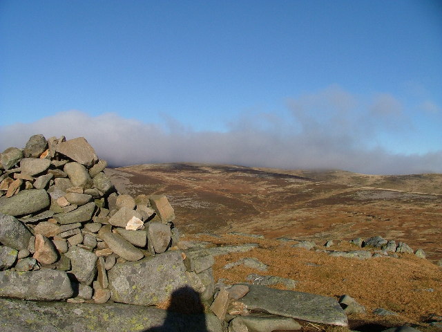
Rising at the head of Glen Callater, this rounded Munro occupies a pivotal spot on the high Mounth plateau. While the summit itself is broad and relatively gentle, it offers a superb vantage point overlooking the dramatic glacial breach of Corrie Fee and the deep troughs of the Angus Glens.
Key Statistics
Rank
23rd Highest in Region
Parent Range
Lochaber
Prominence
?
73.7m
Nearest Town
Braemar
Geology
The peak’s foundation consists of hard, quartz-rich rock and banded, layered stones. These are reinforced by deep veins of tough, crystalline igneous rock.
Find It
OS Grid Reference
NO210800
Latitude
56.9046°N
Longitude
3.2988°W
Did You Know?
- •The name likely derives from the Gaelic An Tollamaint, meaning 'The Hill of the Hollow', which refers to the deep indentation of the landscape at the head of Glen Callater and the nearby pass.
- •Tolmount is famously paired with its neighbour Tom Buidhe; the two are often reached via the long approach from Auchallater near Braemar or by ascending the steep path from Glen Doll in the south.
- •The hill stands guard over Jock’s Road, an ancient and high-altitude droving track. It remains one of the most celebrated rights of way in the Highlands, linking the Braemar area to the Angus Glens.
- •The summit offers a starkly specific contrast in views: to the north-west lies the massive, stony bulk of Lochnagar, while to the south, the plateau abruptly ends at the spectacular, steep-sided rim of Corrie Fee.
- •The traverse between Tolmount and Tom Buidhe is widely regarded as one of the most character-building stretches of bog in the Grampians, regardless of how little rain has fallen recently.