Scotland
Swatte Fell
730M
2395FT
About Swatte Fell
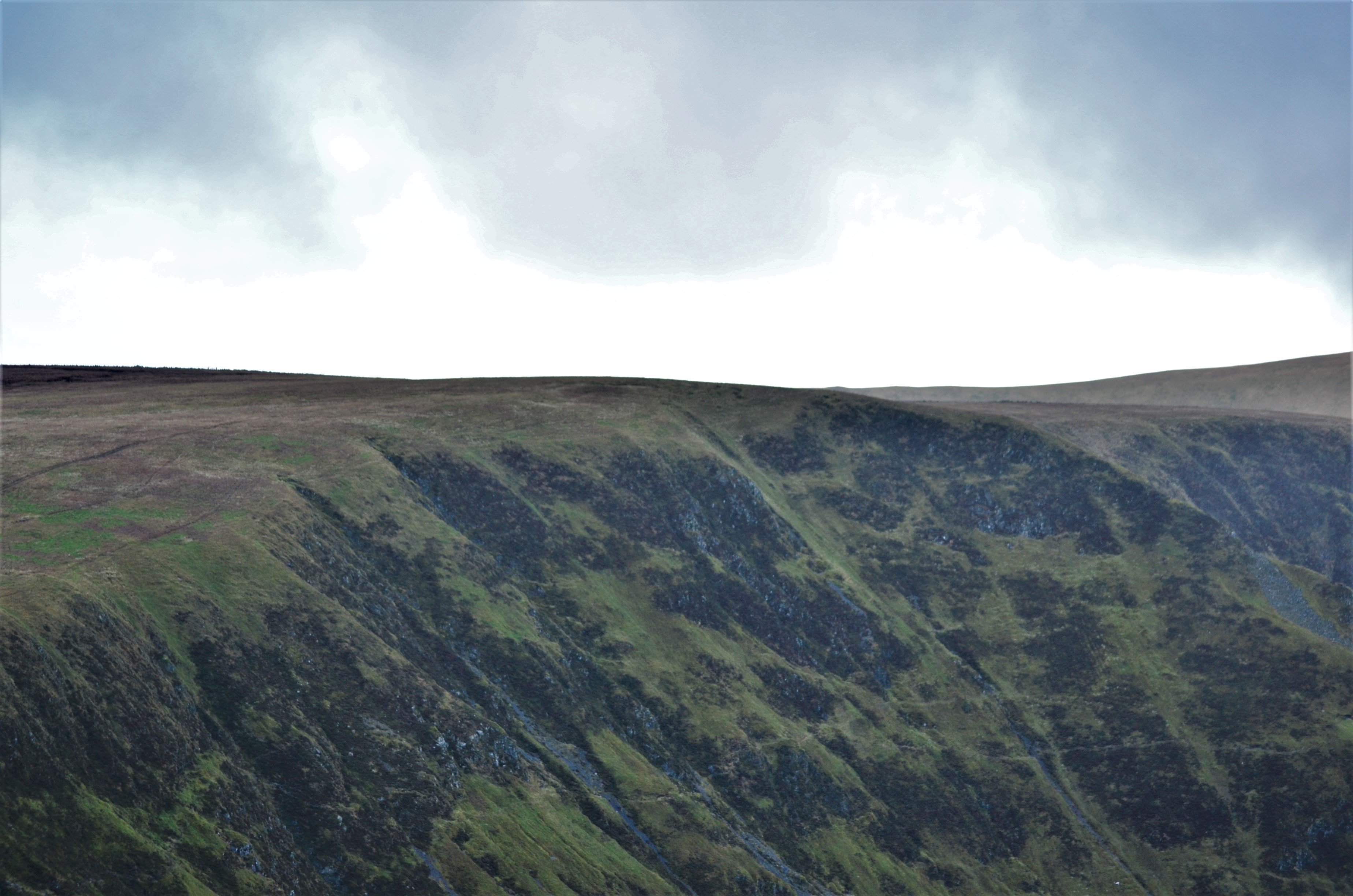
Tucked away in the Moffat Hills, this Donald provides a striking duality of terrain. While its western slopes are soft and rounded, the eastern face drops sharply into the Blackhope glen via the craggy Coomb Craig. It is most rewarding when walked as part of the classic Hart Fell Horseshoe.
Key Statistics
Find It
OS Grid Reference
NT118113
Latitude
55.3885°N
Longitude
3.3931°W
Did You Know?
- •The name derives from the Old Norse 'svartr' or Old English 'sweart', meaning black or dark, a likely reference to the shadowed, north-east facing precipices of the Blackhope corrie that bite into the hill’s flank.
- •The dramatic Coomb Craig ridge, which rises steeply from the floor of Blackhope to the summit plateau, gained minor fame when it was chosen as the cover image for the Ordnance Survey Explorer 330 map.
- •It is a primary component of the Hart Fell Horseshoe, a classic high-level circuit that traverses the rim of the Blackhope glen and provides a clear view of the 'hanging' valley of Hart Fell Crag.
- •From the summit, the view eastward is dominated by the sharp, narrow ridge of Saddle Yoke, while on clear days, the Solway Firth is visible to the south beyond the town of Moffat.
- •Despite the name suggesting a dark and brooding peak, the approach from the south is so relentlessly grassy and rounded that you may spend more time checking your GPS for a summit than catching your breath.