Lake District
Staveley Fell
265M
869FT
About Staveley Fell
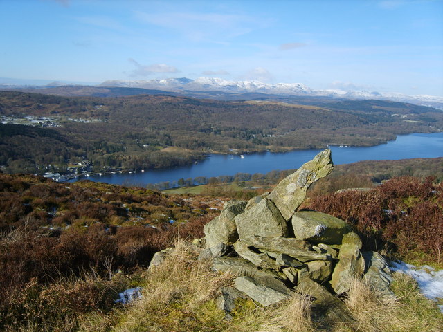
Tucked away near the foot of Windermere, this low-lying Wainwright Outlying is defined by its rugged, wooded character. Often bypassed for its taller neighbour, Gummers How, the fell offers a secluded scramble through birch and bracken to a rocky summit with narrow, rewarding views across the southern reach of the lake.
Key Statistics
Rank
826th Highest in Region
Parent Range
Far Eastern Fells
Prominence
?
42m
Nearest Town
Staveley-in-Cartmel
Geology
The ground beneath you is the Bannisdale Formation, made of alternating layers of siltstone and mudstone.
Classifications
Find It
OS Grid Reference
SD389868
Latitude
54.2738°N
Longitude
2.9390°W
Did You Know?
- •The name derives from the Old English 'stæf' (staff or pole) and 'leah' (a clearing), suggesting a woodland where wood for staves was harvested. It takes its name from the nearby village of Staveley-in-Cartmel, which is often confused with the larger Staveley village located several miles to the northeast.
- •Alfred Wainwright included this modest height in his 'The Outlying Fells of Lakeland', noting it as part of a quiet circular walk from Newby Bridge. He championed hills like this for their 'charming retirement' from the busy central fells.
- •Specific vantage points near the summit provide a clear perspective of the southern tip of Windermere and the steep slopes of Gummers How directly to the east, while the Coniston fells are visible on the northwestern horizon.
- •The fell was historically important for the local charcoal-burning industry, and the remains of old woodland tracks and platforms can still be found amongst the trees on the lower slopes.
- •At 265 metres, the fell is frequently locked in a height competition with the surrounding oak and larch canopy; on some approaches, the primary navigational challenge is looking through the trees rather than over them.