Lake District
Starling Dodd
633M
2076FT
About Starling Dodd
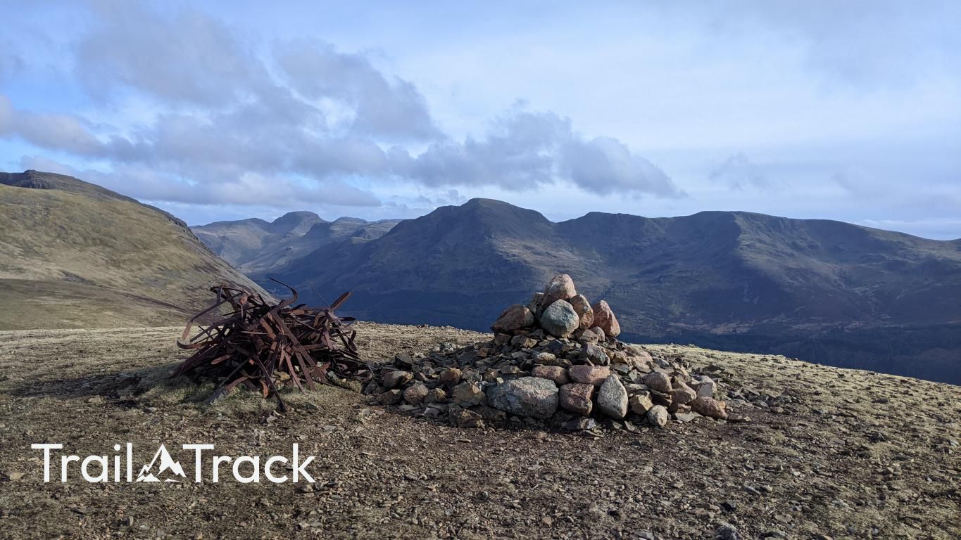
Tucked between the High Stile ridge and Great Borne, this rounded, grassy summit offers a quieter alternative to its more dramatic neighbours. Often bypassed by those rushing toward Red Pike, it rewards the patient walker with a striking, industrial-looking iron summit cairn and an expansive view down the length of Ennerdale Water.
Key Statistics
Rank
228th Highest in Region
Parent Range
Western Fells
Prominence
?
72m
Nearest Town
Loweswater
Geology
You are walking over a foundation of mudstone and hard granite. These rocks formed from compressed silt and cooling underground molten stone.
Find It
Latitude
54.5297°N
Longitude
3.3272°W
Did You Know?
- •The name combines the bird with the Cumbrian term 'Dodd', which stems from the Old Norse 'doddi', used to describe a bare, rounded hill or a limb-like projection from a larger massif.
- •Alfred Wainwright was particularly struck by the summit's unique cairn, which features a tangled mass of old iron fencing wire and posts, describing it as a 'curious object' in an otherwise soft landscape.
- •The summit offers an unobstructed view of the Loweswater Fells to the north, specifically the twin humps of Mellbreak and the dark profile of Grasmoor across the Crummock Water valley.
- •It serves as a vital link for walkers completing the high ridge between Ennerdale and Buttermere, providing a unique vantage point to study the rugged northern face of Pillar across the valley.
- •Reaching the top requires a certain tolerance for damp feet; the surrounding depressions are notoriously boggy, ensuring that your boots will likely be significantly heavier upon departure than they were at the start.