Northern Ireland
Slieve Donard
850M
2789FT
About Slieve Donard
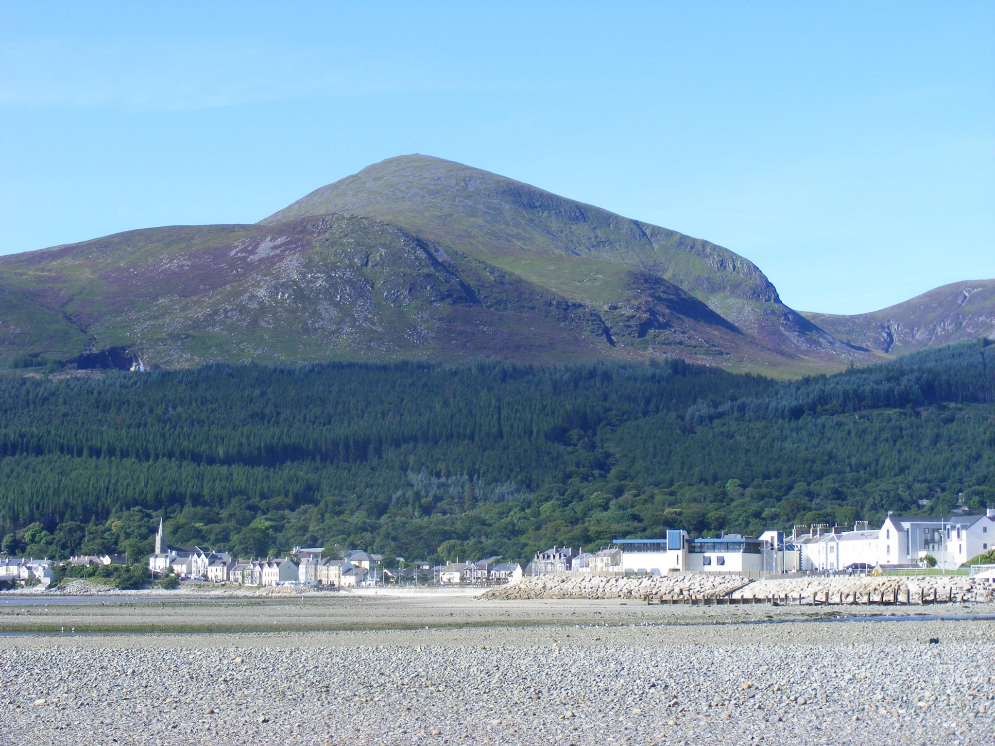
Towering over the seaside town of Newcastle, Ulster’s highest peak offers a rugged ascent alongside the historic Mourne Wall. The granite summit provides an immense coastal perspective, where the Irish Sea meets the peaks of Slieve Commedagh and Slieve Lamagan, stretching across to the Isle of Man on clear days.
Key Statistics
Find It
OS Grid Reference
J358276
Latitude
54.1803°N
Longitude
5.9208°W
Did You Know?
- •The mountain's name comes from the Irish 'Sliabh Dónairt', meaning 'Dónairt's Mountain'. It refers to Saint Donard, a 5th-century follower of St. Patrick who established a hermitage on the summit. Local lore suggests he was a local chieftain converted by Patrick who spent his later years in prayer on the peak.
- •The summit is bisected by the Mourne Wall, a 22-mile dry stone boundary built between 1904 and 1922 to protect the catchment area of the Silent Valley reservoir. Hand-built from local granite, the wall stands up to 2.5 metres high and serves as a vital navigational handrail for walkers in the frequent Mourne mists.
- •The most common ascent follows the Glen River through Donard Park, climbing through coniferous forest before reaching the 'Ice House' and the open mountain. From the saddle between Donard and Commedagh, the final ascent is a steep, stony climb of 300 metres that stays tight to the northern side of the Mourne Wall.
- •Visibility from the summit is exceptional due to its coastal position. Beyond the immediate granite peaks of Slieve Binnian and Slieve Bearnagh, you can see the Wicklow Mountains to the south, the Galloway coast of Scotland to the east, and occasionally the distant profiles of Snowdonia and the Lake District.
- •Despite its 850-metre stature, the summit often feels less like a remote wilderness and more like a busy social club, as a significant portion of the population of County Down appears to spend their public holidays making the pilgrimage to the cairn in trainers.