Scotland
Sgurr na Feartaig
863M
2831FT
About Sgurr na Feartaig
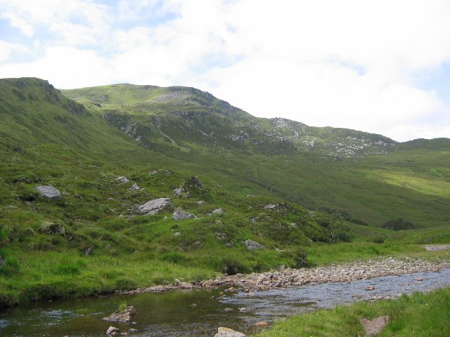
Rising steeply above the southern flank of Glen Carron, this long, heathery Corbett ridge offers a high-level traverse with a distinct mountain feel. A well-constructed stalker’s path eases the ascent, leading to a sprawling summit plateau that serves as an excellent vantage point for the rugged Monar forest peaks nearby.
Key Statistics
Rank
43rd Highest in Region
Parent Range
North West Highlands
Prominence
?
267m
Nearest Town
Data coming soon
Geology
The ground here is made of Morar Group psammite. This is a hardened sandstone that creates the sturdy, rocky ridges you are climbing today.
Find It
OS Grid Reference
NH055453
Latitude
57.4570°N
Longitude
5.2437°W
Did You Know?
- •The name Sgùrr na Feartaig translates from Gaelic as the 'Peak of the Little Ditch' or 'Trench', likely referring to the deep, dramatic gullies and incisions that cut into its steep northern face above Glen Carron.
- •The northern ascent is facilitated by an exceptionally well-built stalker's path that zig-zags up from Pollan Buidhe, a relic of the Victorian era when such paths were engineered to allow ponies to carry deer down from the high ridges.
- •From the summit, walkers are treated to a clear, unobstructed profile of the neighbouring Munros, specifically the massive bulk of Sgùrr Choinnich and Sgùrr a' Chaorachain to the south and the jagged skyline of the Torridon hills to the northwest.
- •The mountain forms the western end of a high, rolling plateau that separates Glen Carron from the remote wilds of the Monar Forest, serving as a gateway to some of the most isolated terrain in the Highlands.
- •Its status as a Corbett—just 51 metres short of Munro status—usually ensures the summit remains quiet, even when the nearby Munros are bustling with activity.