Wales
Rhos Fawr
307M
1008FT
About Rhos Fawr
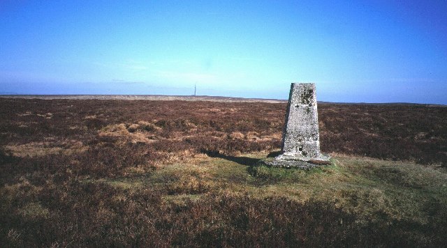
Rhos Fawr is a modest hump in the heart of Powys that barely justifies its name, which translates to 'Large Moor.' It's the kind of place where you’re more likely to encounter a confused ewe than a fellow hiker, providing solitude and excellent views of the nearby turbines.
Key Statistics
Rank
796th Highest in Wales
Parent Range
Central Wales
Prominence
?
124m
Nearest Town
Ashbourne
Geology
Silurian Grits and Shales
Nearby Fells
Find It
OS Grid Reference
SN999883
Latitude
52.4834°N
Longitude
3.4755°W
Did You Know?
- •The summit sits on a high plateau that forms part of the catchment for the River Severn, which begins its long journey just a few miles to the west in the Plynlimon range.
- •It is located near the Llandinam Wind Farm, which was one of the first major commercial wind projects in the UK when it opened in 1992, forever changing the local skyline.
- •The local geology consists of Silurian mudstones and sandstones, which explains why the ground feels like a wet sponge for approximately ten months of the year.
- •Because it reaches exactly 307 meters, it clings to its status as a 'mountain' by the skin of its teeth, providing a sense of accomplishment to those who measure in feet.
- •Navigating this moor in the mist is less about maps and more about a sixth sense for avoiding bogs; if you find yourself following a sheep, remember they have no regard for your dry socks.