Wales
Pegwn Mawr
585M
1920FT
About Pegwn Mawr
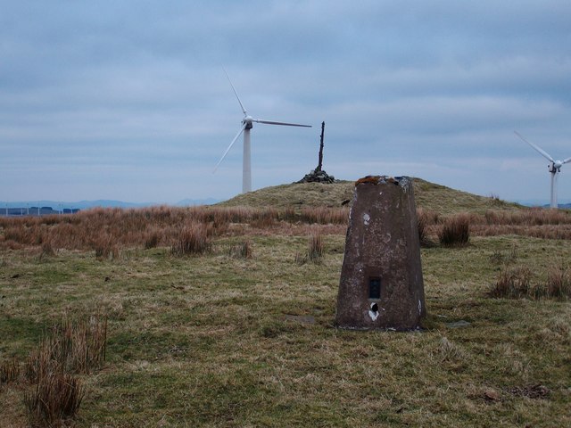
Standing at 585m, Pegwn Mawr is the breezy crown of the Llandinam Hills. It’s a place where Bronze Age ancestors meet modern energy; you can contemplate ancient burial mounds while being serenaded by the rhythmic, slightly judgmental 'whoosh' of the Llandinam wind farm turbines.
Key Statistics
Find It
OS Grid Reference
SO023812
Latitude
52.4200°N
Longitude
3.4381°W
Did You Know?
- •The summit is home to two prominent Bronze Age round barrows, suggesting that prehistoric locals had a much better grasp of 'prime real estate' than we do today.
- •It hosts one of the UK’s oldest commercial wind farms, which has been harvesting the relentless Mid-Wales gales since 1992 to power local kettles.
- •Located in Montgomeryshire, it sits within Powys—a county so large it covers a quarter of Wales, though most of that is admittedly sheep and very steep grass.
- •The Glyndŵr's Way National Trail passes nearby, allowing hikers to follow in the footsteps of the last native Prince of Wales while checking their GPS every five minutes.
- •Hiking here in the fog is an exercise in surrealism where every identical wind turbine feels like a glitch in the Matrix. You haven't truly lived until you've been spooked by a giant mechanical arm appearing out of the mist.