Wales
Moel Sych
827M
2712FT
About Moel Sych
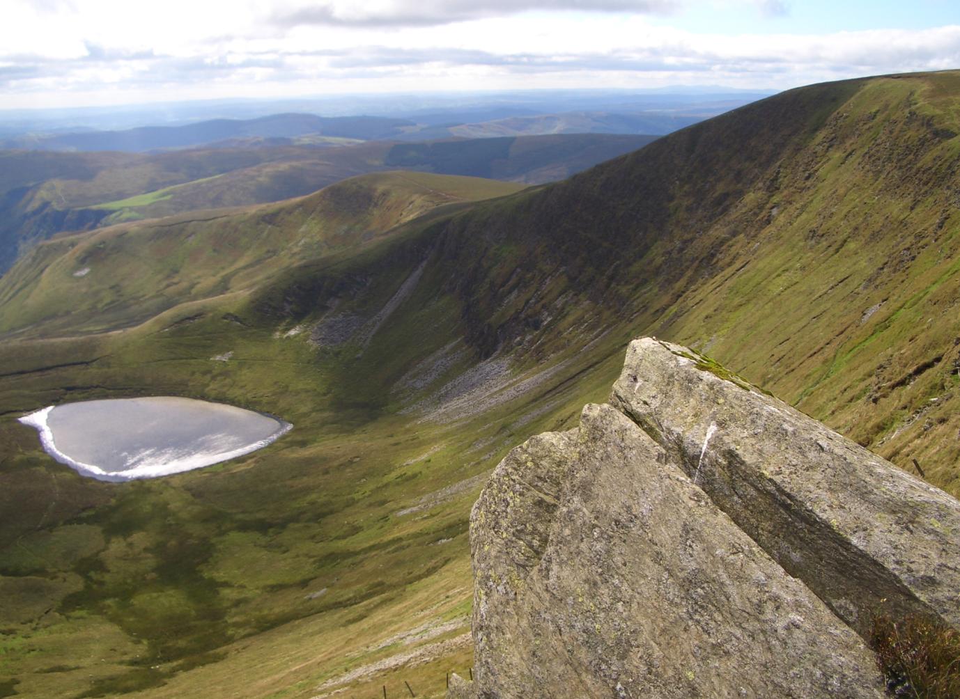
Moel Sych is the 'Dry Hill' that isn't, a high point in the Berwyns that spent years arguing with its neighbor, Cadair Berwyn, over who was truly the taller. It’s a vast, peaty plateau where the views are expansive and the ground is consistently treacherous for expensive boots.
Key Statistics
Rank
33rd Highest in Wales
Parent Range
Snowdonia
Prominence
?
33.9m
Nearest Town
Whaley Bridge
Geology
You are walking on ancient hardened mud and cooled volcanic rock. These layers formed when molten rock pushed into muddy ground during the Ordovician period.
Find It
OS Grid Reference
SJ066318
Latitude
52.8755°N
Longitude
3.3892°W
Did You Know?
- •It stands as the historic county top for the old county of Montgomeryshire and currently straddles the border between Powys and Denbighshire. The ridge walk to its twin, Cadair Berwyn, is one of the finest high-level strolls in North Wales.
- •Despite its name translating to 'Dry Hill' in Welsh, the summit is part of a sprawling blanket bog. It requires a certain level of linguistic irony to navigate the saturated peat hags while remaining upright.
- •The mountain overlooks the stunning Llyn Lluncaws, a glacial corrie lake steeped in local folklore. It’s the perfect spot to stop and wonder why you didn't just stay at the bottom by the waterfall cafe.
- •It was long considered the highest point in the Berwyn range until a 19th-century Ordnance Survey revision gave the title to Cadair Berwyn by a mere few meters. It’s basically the 'Buzz Aldrin' of Welsh peaks—second place but still plenty high.
- •Navigating the summit plateau in mist is less of a hike and more of a tactical retreat from knee-deep sludge. If you finish the walk with clean trousers, you probably haven't actually reached the top; you've just hallucinated a dry path.