Peak District
Lose Hill
476M
1562FT
About Lose Hill
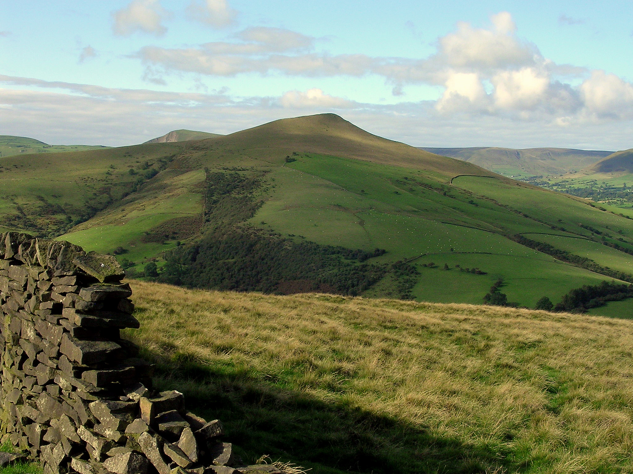
Terminating the eastern end of the iconic Great Ridge, this shapely peak offers a commanding perspective over the Hope Valley and Edale. The ascent from Castleton is steep but rewarding, leading to a summit toposcope and expansive views of the dark gritstone edges of Kinder Scout and Win Hill.
Key Statistics
Rank
68th Highest in Peak District
Parent Range
The Peak District
Prominence
?
85m
Nearest Town
Castleton
Geology
You are walking on layers of sandstone and siltstone. These rocks form the foundation of Lose Hill, creating the paths and ridges you see today.
Nearby Fells
Find It
OS Grid Reference
SK153853
Latitude
53.3641°N
Longitude
1.7701°W
Did You Know?
- •Local legend attributes the names of Lose Hill and its neighbour, Win Hill, to a 7th-century battle between the armies of Northumbria and Wessex. While the story of a victorious and a defeated army suggests a bloody origin, the name more likely derives from the Old English 'hlose', meaning a shed or pigsty.
- •The summit was presented to the public in 1945 by the Sheffield and District Federation of the Ramblers’ Association. A bronze toposcope marks the donation, which was intended to preserve the hill's open access for future generations of walkers.
- •It forms the eastern anchor of the Great Ridge, a two-mile skyline walk that links Lose Hill to Mam Tor via the narrow, rocky outcrop of Back Tor. This path offers a clear geographical divide between the limestone 'White Peak' to the south and the gritstone 'Dark Peak' to the north.
- •From the summit, the view to the east is dominated by the sharp, thorn-like profile of Win Hill. Looking north across the Vale of Edale, the massive peat-covered plateau of Kinder Scout is visible, while the chimneys of the Hope Cement Works provide a stark industrial landmark in the valley floor below.
- •Despite the name, reaching the top feels like a distinct victory, particularly if you have slogged up the direct, lung-bursting path from Castleton rather than strolling along the ridge from the west.