Lake District
Ladyside Pike
703M
2308FT
About Ladyside Pike
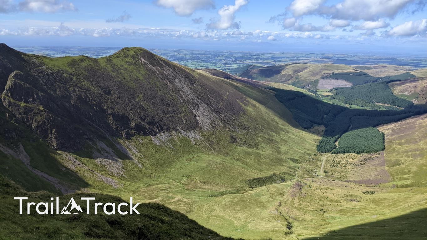
Standing as a prominent northern sentinel to Hopegill Head, this rocky Nuttall offers a quieter alternative to the busier Coledale fells. Its steep, heather-clad slopes provide a rugged ascent from the Whinlatter Pass, rewarding walkers with a sharp, airy perspective over the Lorton Valley and the dark timber of the Whinlatter forest.
Key Statistics
Rank
153rd Highest in Region
Parent Range
North Western Fells
Prominence
?
29.2m
Nearest Town
Buttermere
Geology
Ladyside Pike is formed from layers of hardened mud and gritty sandstone. These sturdy rocks provide the solid foundation for the path beneath your feet.
Classifications
Find It
Latitude
54.5933°N
Longitude
3.2630°W
Did You Know?
- •The name likely derives from the Middle English 'lade', referring to a watercourse or a path, describing the drainage or the ancient tracks that skirt the base of this northern ridge.
- •Although Alfred Wainwright excluded it from his primary 214 fells, he spoke highly of the ridge connecting it to Hopegill Head, describing the approach as having 'graceful lines' and an almost alpine character.
- •The summit offers an exceptional, 'low-angle' view across to the Grasmoor massif and the Crummock Water fells, providing a scale of the North Western fells that is often lost from higher peaks.
- •The ridge between this summit and its parent peak features outcrops of Skiddaw Slate, creating a narrow, interesting crest that requires a steady hand but offers one of the most scenic high-level walks in the Braithwaite area.
- •It serves as a sobering reality check for those descending from Hopegill Head; what looks like a quick stroll back to the car often turns into a surprisingly intricate navigation through a labyrinth of heather and hidden rocky steps.