Lake District
Graystones
455M
1493FT
About Graystones
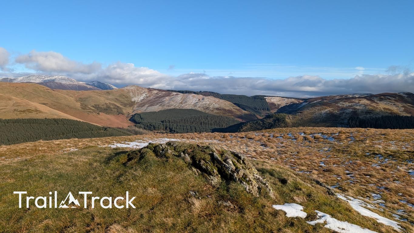
Tucked away above the Whinlatter Pass, this modest Birkett offers a quiet escape from the busier fells nearby. Its grassy slopes and conifer-fringed base lead to a summit with surprising clarity, overlooking the Vale of Lorton and the steep northern flanks of Grisedale Pike and Hopegill Head.
Key Statistics
Rank
495th Highest in Region
Parent Range
North Western Fells
Prominence
?
77m
Nearest Town
High Lorton
Geology
You’re walking on layers of hardened mud and gritty sandstone. These sediments form the Kirk Stile and Loweswater formations that make up this rugged fell.
Classifications
Find It
Latitude
54.6262°N
Longitude
3.2750°W
Did You Know?
- •The name derives from the Old English 'græg' and 'stan', referring to the prominent grey rocky outcrops found near the summit. While many Lakeland fells are named for their Norse owners, Graystones is a simple descriptive marker for those navigating the ridge above Aiken Beck.
- •It is frequently bagged alongside its loftier neighbours, Broom Fell and Lord's Seat, forming a horseshoe around the Aiken Beck valley. The ascent from the Whinlatter Forest side often involves negotiating the ever-shifting perimeter of conifer plantations.
- •From the summit, you get a particularly sharp perspective of the 'back' of the Coledale Fells; the dramatic northern screes of Grisedale Pike and Hopegill Head look far more imposing from here than they do from the Braithwaite side.
- •Despite its distinct summit, Alfred Wainwright did not grant Graystones its own chapter in his Pictorial Guides, instead relegating it to a subsidiary shoulder of Whinlatter. It was left to later authors like Bill Birkett and Timothy Synge to formalise its status as a peak in its own right.
- •For a hill named Graystones, you may find the summit somewhat lacking in significant boulders, though the nearby boundary stone does its best to uphold the reputation of the name. Not that you'll mind, you'll be too exhausted from the steep (understatement) incline you've just crawled up to care.