Scotland
Glas Maol
1068M
3503FT
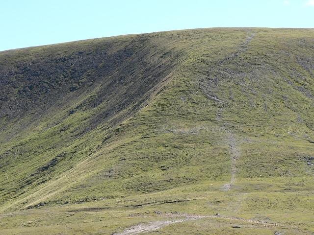
About Glas Maol
Dominating the eastern side of the Cairnwell Pass, this broad, high-altitude plateau offers one of Scotland's highest-starting Munro ascents. Its expansive summit, marked by a trig pillar and a substantial cairn, provides a vantage point over the deep troughs of Caenlochan Glen and the distant, jagged silhouette of Lochnagar.
Key Statistics
Rank
5th Highest in Region
Parent Range
Lochaber
Prominence
?
195.2m
Nearest Town
Braemar
Geology
You are walking on the Ben Eagach Schist, a dark, carbon-rich rock. It formed when ancient mud was transformed by intense heat and pressure deep underground.
Find It
OS Grid Reference
NO166765
Latitude
56.8724°N
Longitude
3.3698°W
Did You Know?
- •The name is derived from the Scottish Gaelic 'A' Ghlas-mheall', meaning 'the grey-green rounded hill'. This accurately describes the mix of mossy heath and exposed scree that characterizes the mountain's vast, wind-swept plateau.
- •The summit serves as a tri-point where the boundaries of Angus, Aberdeenshire, and Perth and Kinross meet. It also holds the distinction of being the highest point in the council area of Angus.
- •A long dry-stone dyke runs along the ridge south towards Creag Leacach. For generations of walkers caught in the Mounth’s notorious mists, this wall has served as a reliable, foolproof navigational handrail.
- •The eastern slopes drop steeply into the Caenlochan National Nature Reserve, a protected area famous for its rare arctic-alpine plants and as a summer breeding ground for the elusive dotterel.
- •Starting the walk from the A93 at 670 metres means you have effectively bypassed the first two-thirds of the mountain, leaving an ascent shorter than many hills in the Pentlands.