Wales
Foel Goch
605M
1983FT
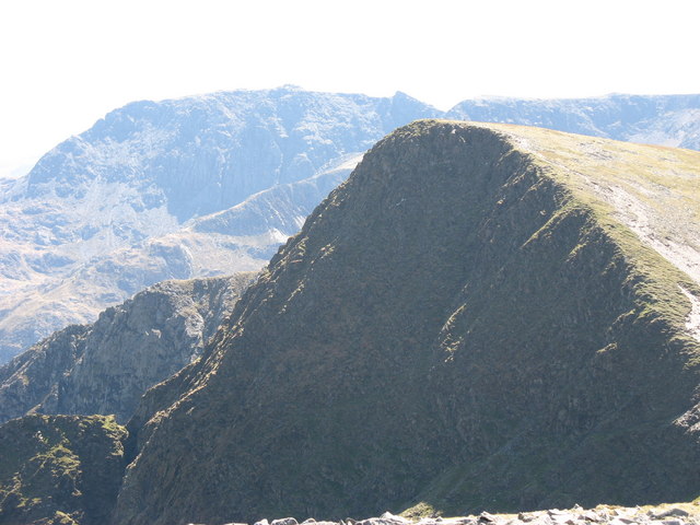
About Foel Goch
Rising in the quiet Berwyn range, this 604.5-metre summit offers a wilder, less-trodden experience than the busier peaks of nearby Snowdonia. Its rounded, heathery profile is characteristic of these moors, rewarding walkers with specific views across the Dee Valley toward the distant Arenig Fawr and the rugged Aran ridge.
Key Statistics
Rank
171st Highest in Wales
Parent Range
Snowdonia
Prominence
?
92.1m
Nearest Town
Llanberis
Geology
You are walking on the Nant Ffrancon Subgroup, which consists of siltstone. This fine-grained rock formed from layers of hardened sediment.
Find It
OS Grid Reference
SH571563
Latitude
53.0847°N
Longitude
4.1350°W
Did You Know?
- •The name derives from the Welsh 'Foel' (bare or bald hill) and 'Goch' (red). This refers to the seasonal colour of the heather and bracken that dominates its slopes, which turns a deep russet-red during the autumn and winter months.
- •The summit is often accessed via the historic Wayfarer’s Track. This ancient pass over the Berwyns was a key route for drovers and became famous in the 1920s when a plaque was installed at the col to commemorate the cycling journalist Walter Robinson, who wrote under the pseudonym 'Wayfarer'.
- •From the summit cairn, the view west provides a perfect silhouette of the Arenig mountains across the Bala fault, while to the south, the jagged profile of the Aran ridge stands out prominently against the skyline.
- •The hill is classified as a Tump—a hill with at least 30 metres of prominence—which in this part of Wales often means the summit provides just enough elevation to catch the full, unobstructed force of the wind blowing in from the Irish Sea.