Wales
Foel Dinas
478M
1568FT
About Foel Dinas
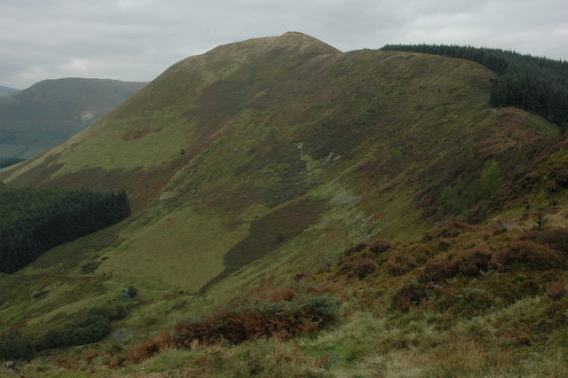
Rising steeply above the Dyfi valley, this prominent Hump offers a sense of scale that belies its modest stature. Climbing via the old Minllyn slate inclines reveals a rugged character and rewards walkers with clear views across to the dramatic cliffs of Maesglase and the higher summits of the Aran ridge.
Key Statistics
Rank
400th Highest in Wales
Parent Range
Snowdonia
Prominence
?
135m
Nearest Town
Dinas Mawddwy
Geology
Foel Dinas is built from layers of hardened mud and silt. These rocks feature patterns left by prehistoric creatures burrowing through the soft sediment.
Find It
OS Grid Reference
SH842143
Latitude
52.7139°N
Longitude
3.7157°W
Did You Know?
- •The name originates from the Welsh 'Foel', meaning a bare or bald hill, and 'Dinas', which historically referred to a fort or stronghold rather than its modern meaning of 'city'. This suggests the summit may have once served as a defensive position overlooking the strategic pass below.
- •The eastern slopes are home to the remains of the Minllyn slate quarry; active during the 19th century, it produced a distinctive dark blue slate and features well-preserved gravity inclines that now serve as a navigational aid for walkers.
- •From the summit, the view south is dominated by the spectacular glacial cwm and craggy face of Maesglase, while to the north, the silhouettes of Aran Fawddwy and Glasgwm provide a rugged backdrop.
- •Despite being named after a fort, the total lack of visible ruins suggests the 'stronghold' either stood the test of time poorly or was merely an ancient exercise in optimistic rebranding.