Wales
Drygarn Fawr
644M
2113FT
About Drygarn Fawr
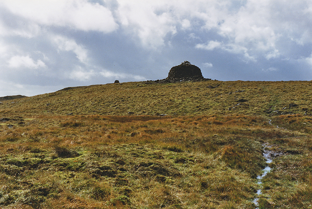
Rising from the wild, boggy plateaus of the Elan Valley, this remote Marilyn is the highest point in the Cambrian Mountains’ mid-section. It is defined by two magnificent, man-made beehive cairns that crown the summit, offering a sense of shelter in the vast, exposed moorland often called the ‘Great Desert of Wales’.
Key Statistics
Rank
11th Highest in Wales
Parent Range
Wales
Prominence
?
257.5m
Nearest Town
Llanwrthwl
Geology
You’re walking over layers of pebbly stone, sandstone, and hardened mud. These rocks include distorted sections where ancient silt and sand once slid and settled.
Find It
OS Grid Reference
SN862584
Latitude
52.2120°N
Longitude
3.6670°W
Did You Know?
- •The name is Welsh and likely translates as 'Great Two Cairns' from the words 'Dwy' (two) and 'Carn' (cairn), referring to the prominent structures on the summit.
- •The summit is crowned by two massive, hollowed-out beehive cairns that serve as essential landmarks and emergency shelters in this notoriously featureless landscape.
- •Situated in the heart of the 'Desert of Wales,' it is one of the most remote hills in the country, requiring a long approach across trackless ground from the Claerwen Reservoir.
- •The vista from the top is exceptionally broad, spanning from the Pumlumon massif in the north to the sharp escarpments of the Brecon Beacons on the southern horizon.
- •Despite its status as a Hewitt and a Marilyn, the hill’s primary defense remains the surrounding peat bogs, which reliably discourage anyone without a sturdy pair of boots and a genuine love for solitude.