Wales
Dinas
445M
1461FT
About Dinas
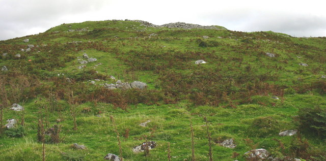
Rising above the rugged Ystwyth Valley in the heart of the Cambrian Mountains, this grassy hump offers a wild, untamed character typical of the Pumlumon range. Its slopes overlook the historic lead mining landscapes of Cwm Ystwyth, providing a quiet vantage point away from the region’s higher, more frequented summits.
Key Statistics
Rank
361st Highest in Wales
Parent Range
Central Wales
Prominence
?
102.4m
Nearest Town
Powys
Geology
You are hiking across layers of ancient mud and sand. These rocks formed from underwater landslides that settled to create the rugged terrain beneath your boots.
Find It
OS Grid Reference
SN904885
Latitude
52.4834°N
Longitude
3.6154°W
Did You Know?
- •The name is derived from the Welsh word for "fort," a common designation for hills that either hosted an Iron Age hillfort or possessed naturally defensive, steep-sided geography.
- •The summit offers a clear perspective of the Pumlumon massif to the north, particularly the sprawling southern slopes of Pumlumon Fawr, the highest point in Central Wales.
- •The eastern flanks overlook the historic Cwm Ystwyth lead mines, where the scarred landscape tells a story of industry stretching from the Bronze Age through to the early 20th century.
- •It is classified as a Hump, a title given to hills with a drop of at least 100 metres on all sides, ensuring it feels like a distinct peak despite its relatively low elevation.
- •Located within what is often called the 'desert of Wales', the hill is so quiet that the local sheep generally consider any visiting walker to be a confusing breach of their privacy.