Wales
Cyrniau Nod
666M
2186FT
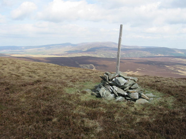
About Cyrniau Nod
Tucked away in the quieter northern fringes of the Berwyns, this broad, heather-clad moorland peak offers a remote experience far from the main ridge crowds. The terrain is classic Welsh upland—rugged, often boggy, and largely trackless—rewarding hikers with an expansive sense of isolation and views stretching toward the Arans.
Key Statistics
Rank
109th Highest in Wales
Parent Range
Snowdonia
Prominence
?
8m
Nearest Town
Powys
Geology
The ground beneath you is formed by the Penstrowed Grits, a sturdy foundation made of layered sandstone and mudstone.
Classifications
Find It
OS Grid Reference
SH988279
Latitude
52.8391°N
Longitude
3.5038°W
Did You Know?
- •The name translates from Welsh as 'The Peaks of the Mark', suggesting these summits served as vital navigation landmarks for travellers or shepherds crossing the often featureless and disorientating Berwyn plateaus.
- •Routes to the summit often involve a long approach from the village of Llandrillo, typically combined with the neighbouring peak of Post Gwyn to create a circular route through the wild Cwm Pennant valley.
- •The summit offers a specific, elevated perspective of the Lake Vyrnwy estate to the south, where the vast forested slopes contrast with the rugged, rocky silhouettes of the distant Aran Fawddwy ridge.
- •Standing at exactly 666 metres, the hill is an inadvertent site of interest for superstitious walkers, though the only truly hellish thing about the experience is the legendary depth of the peat hags on a wet afternoon.