Lake District
Clough Head
726M
2381FT
About Clough Head
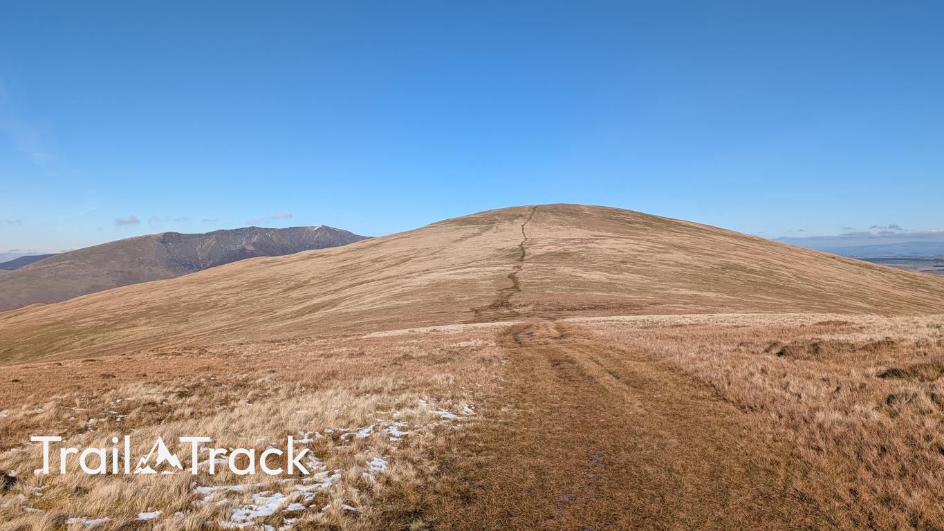
Guarding the northern edge of the Helvellyn range, this fell offers a striking contrast between its smooth eastern slopes and the craggy, ravine-scored face overlooking St John’s in the Vale. It provides a grandstand view of Blencathra and the Skiddaw massif across the A66, serving as a sturdy, high-altitude gateway to the ridge.
Key Statistics
Rank
135th Highest in Region
Parent Range
Eastern Fells
Prominence
?
108m
Nearest Town
Legburthwaite
Geology
You are walking across an ancient volcanic landscape. The ground beneath you consists of solidified lava, hardened ash, and layers of compressed mud and sand.
Classifications
Find It
Latitude
54.5937°N
Longitude
3.0324°W
Did You Know?
- •The name derives from the Old English 'clōh', meaning a deep, wooded ravine or narrow valley. It refers specifically to the steep-sided cleft on the northern face that drops away toward the village of Threlkeld.
- •Alfred Wainwright considered the view of Blencathra from this summit to be one of the best in the district, noting that the mountain appears in its most spectacular aspect when viewed across the Glenderamackin valley.
- •The fell’s geology is remarkably diverse; the lower slopes at Threlkeld Knotts consist of a distinct microgranite intrusion which was heavily quarried for railway ballast and road stones until the mid-20th century.
- •The Old Coach Road, a rough 18th-century track passing beneath the northern slopes, was once the primary link between Penrith and Keswick before the modern A66 was constructed in the valley below.
- •Despite being the definitive northern gateway to the Helvellyn range, the initial ascent from the A66 is a notoriously uncompromising, calf-stretching wall of grass that offers very few zig-zags for the faint-hearted.