Lake District
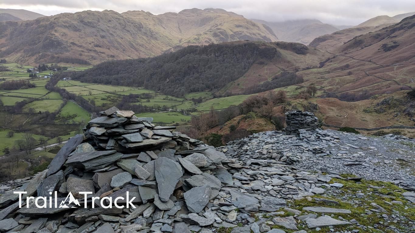
Castle Crag
290M
951FT
About Castle Crag
Don't let its height fool you; Castle Crag packs more character into its 290 metres than many mountains twice its size. Located in the heart of Borrowdale, the steep climb through loose slate spoil rewards you with some of the finest valley views in the Lake District.
Key Statistics
Rank
797th Highest in Region
Parent Range
North Western Fells
Prominence
?
135m
Nearest Town
Grange
Geology
You walk on layers of volcanic ash and reworked lava that formed sandstone and andesite during ancient eruptions. The Borrowdale Sill also intrudes here.
Classifications
Find It
Latitude
54.5332°N
Longitude
3.1616°W
Did You Know?
- •The summit area houses the remains of an Iron Age hillfort, strategically positioned to command the 'Jaws of Borrowdale' and monitor movement through the valley toward the coast.
- •Much of the fell’s dramatic profile is the result of extensive slate quarrying; the path to the top traverses a massive, rattling bank of loose spoil from the now-defunct extraction sites.
- •It holds the unique distinction of being the only hill under 1,000 feet (300m) included in Alfred Wainwright's Pictorial Guide to the Lakeland Fells, earning its spot through sheer 'rugged individuality'.
- •At the summit, a circular memorial plaque is dedicated to Sir William Hamer, though most hikers find themselves distracted by the countless miniature slate towers built by previous visitors.
- •While it’s the smallest Wainwright, the final push over the shifting slate scree can feel like climbing a giant pile of discarded dinner plates, making for a surprisingly loud and clattery ascent.