Lake District
Brown Pike
682M
2238FT
About Brown Pike
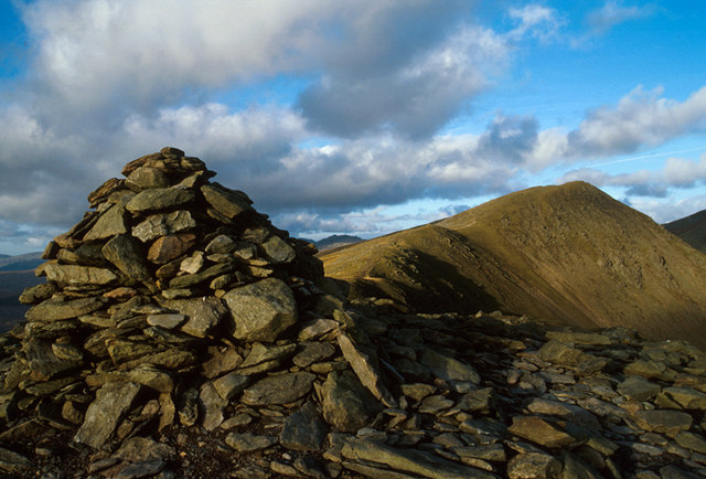
Standing as the southern gateway to the high Coniston fells, this sharp-peaked summit offers a dramatic introduction to the ridge. The historic Walna Scar Road passes just below its shoulder, providing a straightforward approach before the terrain steepens toward the neighbouring heights of Buck Pike and Dow Crag.
Key Statistics
Rank
174th Highest in Region
Parent Range
Southern Fells
Prominence
?
13m
Nearest Town
Torver
Geology
Beneath your boots lie layers of ancient volcanic ash, sandy debris, and hardened lava flows that form this fell’s rugged foundation.
Classifications
Find It
OS Grid Reference
SD260965
Latitude
54.3595°N
Longitude
3.1389°W
Did You Know?
- •The name is derived from the Old English 'pic', meaning a pointed hill, with 'brown' referring to the heather and grasses that clothe its slopes, providing a stark visual contrast to the grey, shattered slate of the fells further north.
- •Access is dominated by the Walna Scar Road, an ancient packhorse route and former quarry track that climbs from Coniston to the 600-metre pass at the fell's southern foot, once the primary transport link to the Duddon Valley.
- •The summit offers a spectacular, dizzying view directly down into Blind Tarn, a perfectly enclosed corrie lake that sits in a rock basin 200 metres below the eastern cliffs.
- •To the south and west, the view opens up significantly, looking across the sprawling Duddon Estuary toward the industrial silhouettes of Barrow-in-Furness and the shimmering expanse of Morecambe Bay.
- •It is a hill that lives up to its name with stubborn literalism, remaining a largely grassy, rounded hump until the very moment the ridge narrows and the 'pike' finally asserts itself.