Lake District
Blea Rigg
542M
1777FT
About Blea Rigg
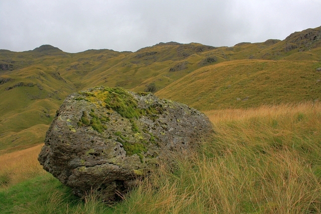
Blea Rigg is a rugged, sprawling ridge connecting Easedale and Great Langdale. While the main path is often elusive, the terrain is a classic mix of craggy outcrops and hidden tarns. It’s a great choice for navigators who enjoy wandering between rocky knolls rather than following a motorway-style trail.
Key Statistics
Rank
345th Highest in Region
Parent Range
Central Fells
Prominence
?
5.6m
Nearest Town
Chapel Stile
Geology
Blea Rigg rests on layers of volcanic‑derived sandstone and breccia, plus nearby breccia of shattered volcanic rocks and ash, all formed from ancient eruptions.
Classifications
Find It
Latitude
54.4611°N
Longitude
3.0788°W
Did You Know?
- •The name 'Blea' is derived from the Old Norse 'blár', meaning dark or leaden-coloured, describing the somber appearance of the fell's craggy outcrops when viewed from the valley floor.
- •Tucked beneath the fell's eastern slopes lies Codale Tarn, a secluded and quiet body of water that sits significantly higher than its better-known neighbor, Easedale Tarn.
- •Geologically, the fell is part of the Borrowdale Volcanic Group, featuring a complex 'knob and kettle' topography of rocky knolls and boggy depressions created by glacial action.
- •Alfred Wainwright famously remarked that Blea Rigg has no clearly defined summit path, calling it a 'delightful playground' where walkers are encouraged to find their own way through the labyrinth of crags.
- •Trying to locate the actual summit cairn in thick mist is a rite of passage; the plateau is so littered with identical-looking rocky humps that you’ll likely claim three different 'summits' before finding the right one.