Scotland
Beinn Mhic Chasgaig
864M
2835FT
About Beinn Mhic Chasgaig
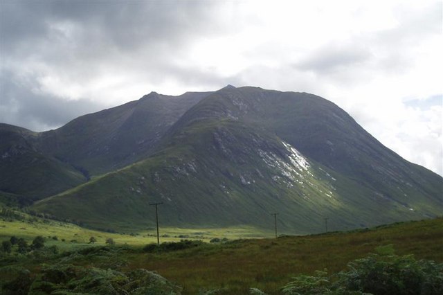
Hidden in the shadow of the Buachaille Etive Beag and Bidean nam Bian, this steep-sided Corbett offers a rugged, craggy alternative to its more famous neighbours. From the head of Glen Etive, its slopes rise sharply, rewarding those who tackle the pathless terrain with intimate views into the Great Wall of Coire Gabhail.
Key Statistics
Rank
77th Highest in Region
Parent Range
The Grampians
Prominence
?
166m
Nearest Town
Data coming soon
Geology
You are walking on granite-like rocks from the Cruachan Intrusion. These are crossed by narrow bands of speckled volcanic rock from the Etive Dyke Swarm.
Find It
OS Grid Reference
NN221502
Latitude
56.6101°N
Longitude
4.8995°W
Did You Know?
- •The name is Gaelic for 'the mountain of the son of Casgaig', though who the eponymous Casgaig was has been lost to local history.
- •Its position at the head of Glen Etive provides a peerless 'insider's' view of the Three Sisters of Glencoe, looking directly into the high, hidden sanctuary of the Lost Valley (Coire Gabhail).
- •Despite being lower than the surrounding Munros, the ascent from the Lairig Eilde is notoriously steep and requires navigating several tiers of crags and rocky outcrops.
- •The hill acts as a quiet sentinel over the Lairig Gartain, the historic mountain pass used for centuries by cattle drovers moving between Glen Etive and Glencoe.
- •It is the kind of hill that teaches a valuable lesson in Scottish geography: 864 metres of pathless, craggy grass can feel considerably more taxing than a thousand metres of well-trodden Munro path.