Scotland
Beinn a' Chlachair
1088M
3569FT
About Beinn a' Chlachair
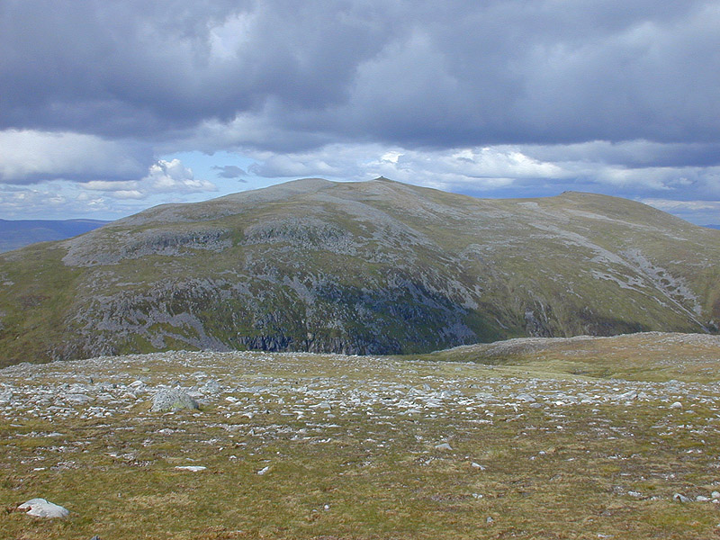
Rising as a massive, whale-backed massif south of Loch Laggan, this Munro is defined by a vast stony plateau and the dramatic, craggy Coire Mòr. It offers a remote high-altitude feel, typically tackled alongside Geal Charn and Creag Pitridh to complete a classic, expansive circuit of the "Laggan Munros."
Key Statistics
Rank
25th Highest in Region
Parent Range
Lochaber
Prominence
?
540m
Nearest Town
Newtonmore
Geology
You are trekking across the Inverlair Psammite Formation, a durable mix of hardened sandstone and layered, flaky rocks formed from compressed silt and mud.
Find It
OS Grid Reference
NN471781
Latitude
56.8690°N
Longitude
4.5100°W
Did You Know?
- •The name translates from Scottish Gaelic as 'Mountain of the Stonemason'. While many nearby peaks have purely descriptive names, this title likely refers to the massive, blocky screes and the architectural appearance of the cliffs encircling the mountain's northern corrie.
- •From the broad summit, the view south is dominated by the remote Ben Alder forest and the long ribbon of Loch Ericht, while the Ben Nevis massif and the Grey Corries form a sharp, jagged skyline to the west.
- •It is the highest of the three Munros in this group. The transition from the steep, rocky ascent near the Bealach Leamhain to the sudden, expansive flatness of the summit ridge is one of the most distinctive landscape shifts in the area.
- •The northern slopes overlook the site of the proposed Earba Storage Project. If constructed, this massive pumped-hydro scheme would use the nearby Loch a’ Bhealaich Bheithe as an upper reservoir, significantly changing the industrial profile of the glen below.
- •The summit plateau is so vast and featureless that even at nearly 1,100 metres, a compass is often more useful for finding the cairn than your eyes are once the mist rolls in.