Scotland
An Tudair
1073M
3522FT
About An Tudair
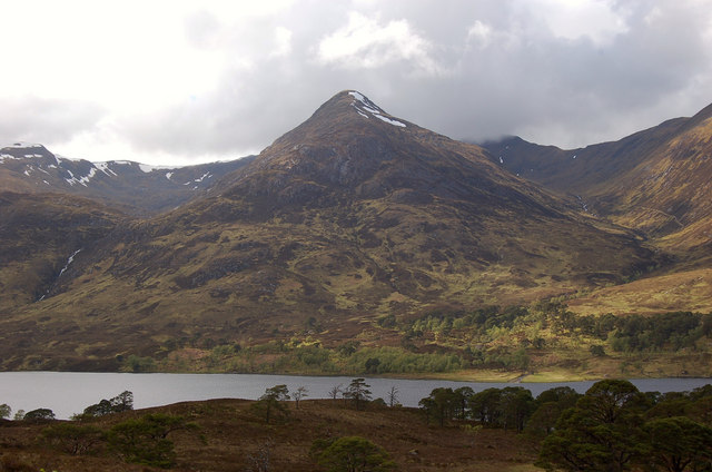
Sitting on the northern ridge of Sgùrr nan Conbhairean, this high Munro Top offers a remote, plateau-like experience in the wild country north of Loch Cluanie. Reaching its stony summit involves a long trek, rewarding walkers with a quiet perspective of the massive Kintail peaks and the nearby Sail Chaoruinn.
Key Statistics
Rank
14th Highest in Region
Parent Range
North West Highlands
Prominence
?
64m
Nearest Town
Highland
Geology
You are walking on ancient muds and sandstones of the Glenfinnan Group. These have been compressed and hardened into the tough, layered rocks that build this fell.
Classifications
Find It
OS Grid Reference
NH127239
Latitude
57.2673°N
Longitude
5.1077°W
Did You Know?
- •The name An Tudair translates from Gaelic as 'The Mound' or 'The Stack', likely referring to its rounded profile when viewed from the lower glens to the north.
- •It is almost exclusively climbed as part of a circuit including the Munro Sgùrr nan Conbhairean, providing a high-level traverse on a broad ridge that remains above 1,000 metres for a significant distance.
- •The summit cairn overlooks the deep, scooped-out Coire Sgoireadail to the east, with the long chain of the South Glen Shiel Ridge dominating the skyline to the south.
- •At over 1,073 metres, this hill is taller than dozens of primary Munros; it serves as a reminder that in the Highlands, 'Top' status is a matter of administrative mapping rather than a lack of physical presence.