Scotland
An Gearanach
982M
3220FT
About An Gearanach
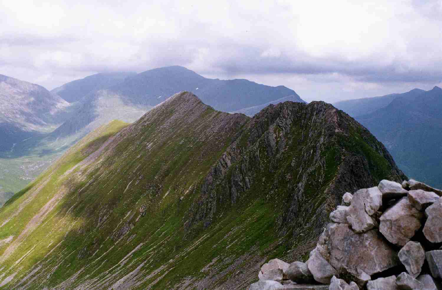
Standing as the northern gateway to the celebrated Ring of Steall, this sharp-crested Munro offers a dramatic introduction to the Mamores. Its narrow quartzite ridges provide an exhilarating scramble, leading to a summit with a direct, plunging view over the An Steall Bàn waterfall and the deep Nevis Gorge.
Key Statistics
Rank
47th Highest in Region
Parent Range
Lochaber
Prominence
?
151.7m
Nearest Town
Fort William
Geology
You are stepping on hard, crystalline sandstone and flaky, layered rocks. These tough, compressed minerals form the rugged ridges and steep slopes of the mountain.
Find It
OS Grid Reference
NN187669
Latitude
56.7583°N
Longitude
4.9673°W
Did You Know?
- •The name is Gaelic for 'The Complainer' or 'The Grumbler,' likely referring to the constant sound of the wind whistling through its narrow ridges or the roar of the nearby Steall waterfall in spate.
- •Reaching the foot of the hill from Glen Nevis usually involves crossing the infamous Steall wire bridge—a three-wire balancing act over the Water of Nevis that serves as a nervous warm-up for the day’s ridge walking.
- •The summit provides a distinctive perspective of Ben Nevis to the north; from here, the mountain reveals its massive southern flanks and the sharp profile of the CMD Arête, rather than the familiar rounded shape seen from the town.
- •The ridge southward toward the subsidiary top of An Garbhanach is a classic section of Mamores scrambling, featuring narrow passages over shattered quartzite that require a steady head and occasional use of hands.
- •If the wire bridge at the base doesn't claim your dignity, the initial ascent likely will; the route begins with a relentlessly steep 700-metre pull that is less of a path and more of a vertical lesson in calf endurance.